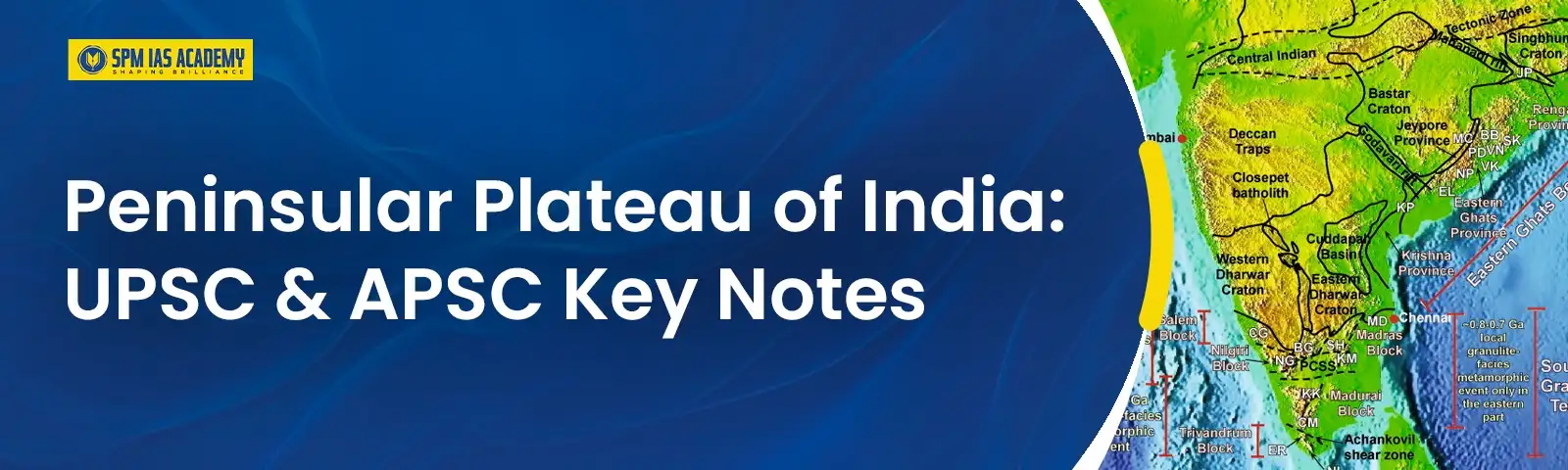
The Peninsular Plateau of India stretches from central to southern India, comprising the Deccan Plateau, Central Highlands, and Northeast Plateau. Further, it features block mountains, rift valleys, and the Western and Eastern Ghats, playing a crucial role in the country’s ecology and climate.
In this article, we will look in detail at the Peninsular plateau of India, studying its regional divisions, geomorphology, features, and its importance in the preparation of the geography syllabus for UPSC and APSC.
Peninsular Plateau of India: An Overview
The Peninsular Plateau of India is a large flat tableland bound by oceans on three sides. The Peninsular Plateau is one of the five major physiographic divisions of Indian physical geography and is also one of the largest and oldest earth masses. It was formed from the Gondwana supercontinent.
Further, the Peninsular Plateau is rich in minerals, containing iron ore, coal, and bauxite. The features of the Peninsular Plateau include numerous landscapes, flatlands, shallow valleys, rounded hills, and flat areas with black soil from ancient volcanic activity.
Features of the Peninsular Plateau of India
The Peninsular Plateau of India, famous for its unique geological formations and diverse ecosystems, plays an important role in the Indian physical geography. Below are some of the features of the Peninsular Plateau:
1. The Peninsular Plateau of India covers 16 lakh square kilometers, shaped like a triangle and bordered by mountains, with rivers mainly flowing to the Bay of Bengal.
2. In addition, the region, at an elevation of 600 to 900 meters, consists of ancient Archaean gneisses and schists, featuring plateaus, hill ranges, river basins, and valleys.
Peninsular Plateau of India: Divisions
The geomorphology of the Peninsular Plateau of India includes major plateaus and major hill ranges. The Peninsular Plateau classification is explained in detail in the sections that follow, as it is an important topic of the geography syllabus for UPSC.
Major Peninsular Plateaus of India
1. Deccan Plateau
Another key point is that the Deccan Plateau is a triangular-shaped region bordered by the Satpura and Vindhya ranges in the northwest, the Mahadev and Maikal ranges in the north, the Western Ghats in the west, and the Eastern Ghats in the east.
- Covers an area of approximately 5 lakh square kilometers.
- Represents the largest component of the Indian Peninsular Plateau.
- Has an average elevation of about 600 meters.
- The general slope descends from west to east.
- Major rivers in the region include:
- Mahanadi
- Godavari
- Krishna
- Cauvery
- Features several smaller plateaus formed by the dissection of these rivers.
It’s important to note that the Maharashtra Plateau has rolling plains and basalt hills by the Godavari, Bhima, and Krishna rivers. In addition, the Karnataka Plateau, with peaks like Mulangiri, features valleys and plains. The Telangana Plateau sits at 500-600 meters, while the Chhattisgarh Plain, drained by the Mahanadi River, is known for its historic forts.
2. The Central Highlands
The Central Highlands, situated east of the Marwar and Mewar uplands in the Chambal River Basin, form a unique part of India’s Peninsular Plateau.
- The region has rolling sandstone hills (700 and 1,000 meters) bordered by the Aravali Range and the Satpura Range (plateaus at 600 to 900 meters).
- The Chambal River and its tributaries, including Kali Sindh and Banas, flow through, aided by the Vindhyan and Kaimur Ranges.
- Key plateaus include Malwa and Chota Nagpur, along with Rajmahal and Garhjat Hills; the Aravali Range is the source of the Sabarmati, Luni, and Banas rivers.
The Malwa Plateau is 500-600 meters high, Bundelkhand ranges 300-600 meters, and Baghelkhand rises from 150-1,200 meters. The Chotanagpur Plateau in Jharkhand averages 700 meters and includes the Damodar River and Rajmahal Hills at 400 meters.
3. Northeastern Plateau
The Meghalaya Plateau is an extension of the main Peninsular Plateau.
- The plateau formed from the northeastward movement of the Indian plate during the Himalayan uplift, creating the Malda gap fault, which was later filled with river deposits.
- It includes Meghalaya, the Karbi-Anglong Plateau, and the North Cachar Hills, featuring three major hill ranges—Garo, Khasi, and Jaintia Hills—named after local tribal communities.
- The plateau extends into the Karbi Anglong hills of Assam, with the Kopili River serving as a natural boundary that separates the Mikir, Regma, and Barail Hills from the Meghalaya Plateau.
Further, the northeastern plateau, part of the Indo-Australian Plate, includes the Meghalaya Plateau with heights up to 1,961 m at Shillong. The Karbi Anglong Plateau in Assam covers 7,000 square kilometers, featuring elevations of 300 to 400 m and abundant minerals.
Major Hill Ranges of the Peninsular Plateaus of India
1. The Western Ghats/ The Sahyadris
The Western Ghats, also known as the Sahyadris, are a significant mountain range that runs parallel to the western coast of India’s Peninsular Plateau.
- The Western Ghats stretch from the Tapi Valley in the north to just north of Kanyakumari in the south.
- They traverse the following regions:
- Gujarat
- Maharashtra
- Goa
- Karnataka
- Kerala
- Tamil Nadu
- Union Territories of Dadra & Nagar Haveli and Puducherry (Mahe)
- The Deccan Plateau lies to the east and the Arabian Sea to the west.
- The range features:
- Steep, flat-topped hills
- Unique stepped topography
- It includes three main sections:
- Northern Section
- Middle Sahyadris
- Southern Section
2. The Eastern Ghats
The Eastern Ghats are a series of discontinuous mountain ranges that border the eastern edge of the Indian Peninsular Plateau, running almost parallel to the east coast of India.
- It stretches from the Mahanadi River in Odisha to the Vagai River in Tamil Nadu.
- Located to the west of the Deccan Plateau.
- Positioned to the east of the Coastal Plains and the Bay of Bengal.
- Comprises a chain of highly broken and detached hills.
- Characterized by a diverse topography.
Significance of the Peninsular Plateau of India
It’s important to note that the peninsular plateau of India is rich in minerals, fertile black soils for cotton, and rain-fed rivers that boost agriculture and hydroelectric power. Below are some reasons that highlight the Peninsular Plateau significance:
- Rich in mineral resources: iron, copper, gold, etc.
- Home to 98% of India’s Gondwana coal deposits.
- Black soil is suitable for crops like cotton, tea, and coffee.
- Abundant forest resources, including timber.
- Rivers enable hydroelectricity generation and irrigation.
- Popular tourist destinations: Ooty, Kodaikanal, Mount Abu, etc.
For students preparing for UPSC geography notes and APSC geography preparation, understanding the plateau’s geological stability, resource richness, and role in the Indian physical geography and climate patterns is fundamental, underscoring its multifaceted importance.
Conclusion
In brief, the Peninsular Plateau of India is a vital geographic feature, rich in resources and ecosystems. Further, it faces challenges like deforestation and soil degradation, highlighting the need for preservation. The Peninsular Plateau remains an important part of Indian physical geography, showcasing the forces that have shaped our planet over millions of years, thus making it an important topic for the UPSC and the APSC examinations.
Frequently Asked Questions
Ans: The Peninsular Plateau of India is a flat tableland located in the southern part of India, surrounded by oceans on three sides. It is also known as the Indian Peninsular Plateau.
Ans: The Peninsular Plateau of India is located in the southern part of the country.
Ans: The Deccan Plateau is considered to be the oldest plateau in India. In addition, it forms a part of the Peninsular Plateau of India, which, in itself, is considered to be the oldest landmass in India.
Ans: The two important plateaus in India are the Deccan Plateau as well as the Chota Nagpur Plateau.
Ans: The Peninsular Plateau was formed as a result of the drifting of the Gondwana landmass and is considered one of the most stable geological regions in India.
Ans: The Peninsular Plateau, also known as the Deccan Plateau, is the oldest landmass of India.
Also Read:

Behind every article at SPM IAS Academy is a team of skilled content writers and subject experts committed to making preparation easier for aspirants. From answering common doubts to breaking down complex issues and current affairs, we create content that is accurate, easy to understand, and directly useful for UPSC, APSC, and other competitive exams.