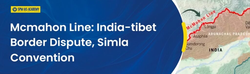
The McMahon Line stands as one of the most discussed geopolitical borders in South Asia, and it continues to shape India-China relations even today. It was drawn during the Simla Convention of 1914, and although it was intended to clearly separate British India from Tibet, instead the boundary has become a point of sharp dispute. The McMahon Line stretches nearly about 890 kilometers, which is mainly through Arunachal Pradesh, and it remains at the heart of long-standing tensions between India and China. Moreover, China disputes the legitimacy of this boundary and claims the parts of the region as South Tibet.
What is the McMahon Line?

The McMahon Line is a boundary which is drawn between British India and Tibet during the Simla Convention. It was first negotiated by Sir Henry McMahon, who served as the Foreign Secretary of British India. Although the boundary was intended to bring clarity, it eventually became a subject of disagreement, particularly after China took control of Tibet in 1950.
The McMahon Line also passes through some of the toughest mountain terrains in the Eastern Himalayas, and it continues to be India’s boundary in the northeast. However, China argued that Tibet was not a sovereign state and therefore had no authority to sign the agreement and refused to accept it.Consequently, the McMahon Line remains deeply linked to India-China relations.
Key Highlights of the McMahon Line
| Aspect | Details |
| Established By | Simla Convention, 1914 |
| Negotiators | Sir Henry McMahon (British India) and Tibetan representatives |
| Border Dispute | China does not recognize the McMahon Line, claiming parts of Arunachal Pradesh as South Tibet |
| Relation to LAC | The Line of Actual Control (LAC) further complicates the border due to unresolved tensions. |
| Significance | It is central to India-China border issues and is a sensitive geopolitical boundary. |
What is the History of the McMahon Line
The origins of the McMahon Line lie in the Simla Convention of 1914, a meeting between British India, Tibet, and China. Although Chinese representatives attended the early sessions, they eventually refused to sign the final draft. Their actual rejection was based on objections to Tibetan autonomy and the demarcation of a boundary. Nevertheless, British India and Tibet signed the agreement and established the McMahon Line. When China annexed Tibet in 1950, it rejected the line entirely. As a result, the boundary became a flashpoint between India and China. Over the decades, mistrust deepened, leading to disputes and military tensions.
India-Tibet Border and the McMahon Line
The India-Tibet border in the eastern sector aligns with the McMahon Line. This territory, especially in Arunachal Pradesh, has remained contested for decades. China continues to claim large parts of the region as South Tibet, triggering repeated diplomatic and military confrontations.
The situation worsened during the 1962 Sino-Indian War, when China crossed the McMahon Line and advanced into Indian territory. Although China later withdrew, the dispute remained unresolved. Even today, India recognises the McMahon Line as its legal boundary, but China maintains its objections.
The McMahon Line in the Sino-Indian War of 1962
The McMahon Line played a central role in the 1962 Sino-Indian War. This disagreement over its legitimacy intensified the tensions in the entire eastern sector. Moreover, China argued that the boundary was imposed without its consent, whereas India consistently upheld the validity of the McMahon Line.
Key Points
- Firstly, China rejected the McMahon Line as it believed it was never part of the agreement.
- Second, Arunachal Pradesh became the point of focus for the territorial dispute.
- Moreover, the Chinese troops crossed the McMahon Line during the 1962 war.
- Additionally, India tried to maintain the line as the line was a legitimate boundary.
- The conflict also cemented the McMahon Line as one of the Asia’s most sensitive borders.
McMahon Line and the Line of Actual Control (LAC)
McMahon Line is a colonial-era boundary, but the Line of Actual Control (LAC) represents the current de facto border between India and China. The LAC is not officially demarcated on the ground, which leads to different perceptions on both sides.
The LAC is divided into:
- First, the Western Sector (Ladakh, Kashmir)
- Second, the Middle Sector (Uttarakhand, Himachal Pradesh)
- Third, the Eastern Sector (Sikkim, Arunachal Pradesh) – aligned with the McMahon Line
As both countries interpret the LAC differently, the tensions continue to rise from time to time.
About the McMahon Line: Key Facts
Here are the key factors about McMahon which are very important to know
- First, it is the mark for the boundary between Northeast India and Tibet.
- Second, it covers nearly 890 km across the Himalayas.
- It stretches from Bhutan’s eastern border to the bend of the Brahmaputra River in Arunachal Pradesh.
- According to India, it is a legal international boundary.
- China rejects India’s concept and states that Tibet had no authority to sign treaties.
- Moreover, it is named after Henry McMahon, the chief negotiator of the Simla Convention.
- The line forms the basis of multiple India-China disagreements.
What was the Simla Treaty of 1914?
The Simla Treaty, which was signed in 1914, aimed to define the boundary between India and Tibet. China was not included in the final agreement as Tibet was functioning as an autonomous region at the time.
Key points of the treaty
- First, it clearly marked the McMahon Line as the boundary.
- Secondly, Tibet and British India acknowledged the Tawang region as part of India.
- Moreover, due to this integration, it helped to form the present-day boundaries of Arunachal Pradesh.
What is the Line of Actual Control (LAC)?
The LAC is a de facto border separating Indian-controlled territory from Chinese-controlled territory.
Important LAC Facts
- India considers it 3,488 km long
- China considers it to be around 2,000 km
- It is divided into three sectors
- The eastern sector aligns with the McMahon Line
As there is no mutually accepted map, misunderstandings frequently occur.
Line of Control (LoC) vs. McMahon Line
The Line of Control (LoC) lies between India and Pakistan in the former princely state of Jammu & Kashmir. It is a de facto border controlled by the armies of both nations. The LoC has no connection with the line of McMahon which marks the India-Tibet boundary.
Conclusion
The line of McMahon remains one of the most significant and sensitive boundaries in modern geopolitics. Even though it was drawn more than a century ago, its impact continues to shape India’s relations with China and influence the strategic landscape of the entire eastern Himalayan region. Over the years, this boundary has been questioned, defended, debated, and revisited, yet its importance has only grown stronger due to its military, political, and historical relevance.
In the end, the story of the McMahon Line reminds us that boundaries are not just lines on a map as they represent history, identity, and national interest. And as long as the debate continues, the McMahon Line will remain a crucial chapter in India’s strategic narrative.
Frequently Asked Questions (FAQs)
The Line of McMahon is a boundary drawn in 1914 between British India and Tibet. India considers it legal, while China rejects it.
It lies in the eastern Himalayas, running through Arunachal Pradesh and forming part of the India-Tibet border.
The Simla Convention was an agreement between British India and Tibet to define their boundary, resulting in the creation of the McMahon Line.
No. China argues that Tibet had no sovereign authority to sign the agreement, so it does not recognize the McMahon Line.
The Line forms the basis of the LAC’s eastern sector. However, differing perceptions of the LAC create frequent tensions.
China claims that the region historically belonged to Tibet, and since it does not recognise this Line, it extends its claim over Arunachal Pradesh.
The Line defines India’s legal boundary in the northeast and serves as a strategic security barrier.
Yes. Disagreements over this Line and territorial claims played a major role in escalating the conflict.
Both countries have different historical interpretations and maps, which lead to contrasting views of the LAC’s alignment.
Yes. India bases its territorial claim on the Simla Convention, and the Line remains a central point in current border negotiations.