For any UPSC aspirant, an understanding of Indian Geography and Polity is non-negotiable. A common, yet crucial, topic that features in both Prelims and Mains is the administrative structure of India. Specifically, knowing about the largest state in India by area, the most populous state, and the unique nature of Union Territories is essential not only for exam but also as a citizen.
This article provides a one-stop solution, breaking down these concepts with key facts and their relevance to your syllabus.
Why knowing about largest state and Union Territory of India is Important for UPSC, APSC and other State PCS Exams?
Understanding facts about the largest states and UTs is important for:
- Geography (GS Paper I): Physical geography of India, distribution of key natural resources.
- Polity (GS Paper II): Federal structure, union and state relations, special status, and governance.
- Economy (GS Paper III): State-wise contribution to GDP, demographic dividend, and regional development.
- Prelims: Direct factual questions on largest/smallest states and UTs.
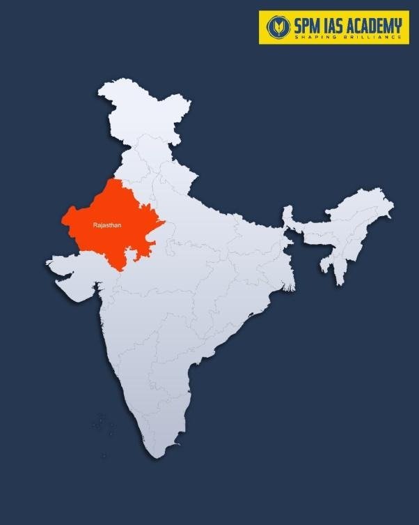
Largest State in India By Area – Rajasthan
Rajasthan – (the king of area) is the largest state by area in India.
- Area: 342,239 square kilometres.
- Capital: Jaipur (the Pink City of India).
Climatology of Rajasthan:
- Geographical Influence: Rajasthan lies in the North-western part of India, mostly covered by the Thar Desert, which significantly influences its arid and semi-arid climate.
- Type of Climate: The state experiences a tropical desert climate, marked by low rainfall, high temperature, and dry conditions throughout most of the year.
- Temperature Range:
- Summers (March–June): Extremely hot; temperatures can exceed 48°C, especially in western districts like Barmer, Jaisalmer, and Jodhpur.
- Winters (November–February): Mild to cold; temperatures may drop to 0°C or below in places like Mount Abu and Churu.
- High diurnal range — hot days and cool nights.
- Rainfall:
- Average annual rainfall: 100–650 mm, decreasing from east to west.
- Western Rajasthan receives less than 100 mm, while southeastern parts (like Kota and Udaipur) get up to 650 mm.
- Rainfall is mainly due to the Southwest Monsoon (June–September).
- Humidity: Generally low humidity, especially in desert regions. The eastern part of the state is relatively more humid during monsoon.
- Winds:
- Hot and dry winds known as Loo blow during summer, causing severe heat waves.
- Dust storms are common in pre-monsoon months due to arid soil and strong winds.
- Regional Variations:
- Western Rajasthan: Arid desert region with sand dunes and extreme temperatures.
- Eastern Rajasthan: Semi-arid region with slightly higher rainfall and fertile plains.
- Southern Rajasthan: Moderately humid due to the Aravalli hills and forested areas.
- Climatic Features:
- High evaporation rates due to strong sunlight and dry air.
- Scanty vegetation caused by arid conditions.
- Frequent droughts in western districts due to irregular monsoon.
- Impact on Agriculture and Lifestyle:
- Farming depends heavily on monsoon rainfall and irrigation (e.g., Indira Gandhi Canal).
- Desert vegetation, camel rearing, and millet cultivation are common adaptations to the climate.
Largest State in India By Population – Uttar Pradesh
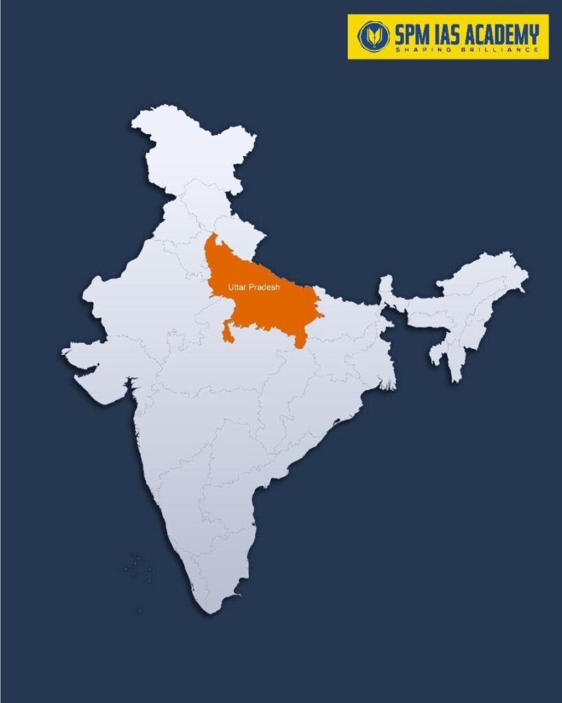
Uttar Pradesh – the Demographic Giant, is the largest state by population in India.
- Population: Over 240 million (As per 2011 Census). As of 2025, it is around 24.13 crore. (17% of the total population of India)
- Capital: Lucknow.
- Key Facts:
- If Uttar Pradesh were a country, it would be the fifth most populous in the world.
- High population density, especially in the Gangetic plains.
- Comprises a largest number of Lok Sabha constituencies (80).
- Physiographic Divisions:
- UP is divided into three major physical regions:
- Gangetic Plains – Fertile alluvial region formed by Ganga and its tributaries.
- Vindhyan Hills and Plateau – Southern part, rich in minerals and forest cover.
- Terai and Bhabar Zone – Northern foothills of the Himalayas, rich in biodiversity.
- UP is divided into three major physical regions:
- Major Rivers:
- Important rivers: Ganga, Yamuna, Ghaghara, Gomti, Son, Betwa, and Chambal.
- The Ganga-Yamuna Doab is the most fertile and agriculturally productive region.
- Climate:
- UP experiences a tropical monsoon climate with hot summers, a humid monsoon season, and cool winters.
- Average annual rainfall ranges from 650 mm in west to 1,000 mm in east.
- Agriculture and Soil:
- Alluvial soil dominates the plains—ideal for wheat, rice, sugarcane, and pulses cultivation.
- The Terai region supports dense forests and wetland ecosystems.
- Reasons for High Population in Uttar Pradesh:
- Large Geographical Area:
- Uttar Pradesh covers 243,286 km2, making it one of India’s largest states by area.
- The vast and fertile Gangetic Plain supports dense human settlement and intensive agriculture, allowing high population sustenance.
- Fertile Land and Agricultural Prosperity:
- The Ganga-Yamuna Doab and other river basins provide highly fertile alluvial soil.
- This supports year-round cultivation and rural livelihoods, attracting and retaining large populations in agrarian regions.
- Early Urbanization and Historical Centres:
- Ancient cities like Varanasi, Prayagraj, and Lucknow have been population centres for centuries.
- Continuous urban and cultural development since ancient times has led to sustained population growth.
- High Fertility Rate:
- UP has a higher Total Fertility Rate (TFR) compared to the national average.
- Socio-economic factors, limited awareness of family planning, and rural lifestyle contribute to faster population growth.
- Economic and Infrastructural Connectivity:
- The state’s central location and strong transport network (railways, highways, and rivers) encourage migration, trade, and settlement.
- It acts as a transit and economic hub connecting northern and eastern India, boosting its population density.
Top 5 States by Area and Population:
| Rank | By Area (Largest) | Area (sq km) | By Population (Most Populous) | Population (2011) |
| 1 | Rajasthan | 342,239 | Uttar Pradesh | 199,812,341 |
| 2 | Madhya Pradesh | 308,245 | Maharashtra | 112,374,333 |
| 3 | Maharashtra | 307,713 | Bihar | 104,099,452 |
| 4 | Uttar Pradesh | 240,928 | West Bengal | 91,276,115 |
| 5 | Gujarat | 196,024 | Madhya Pradesh | 72,626,809 |
Understanding Union Territories (UTs) in India:
The unique administrative division of Union Territories is a distinguishing feature of Indian federalism. Unlike states, Union Government directly administers these Union Territories. The President of India administers these territories through an Administrator (Lieutenant Governor).
Types of Union Territories:
- UTs with Legislature: Delhi, Jammu & Kashmir, and Puducherry.
- These have a partially elected legislative assembly and a council of ministers. Here, the Lieutenant Governor holds significant executive power.
- UTs without Legislature: Andaman and Nicobar Islands, Chandigarh, Dadra and Nagar Haveli and Daman and Diu, and Lakshadweep.
- These are directly ruled by the Central Government through an Administrator.
Largest Union Territory of India by Area (2025): Jammu and Kashmir:
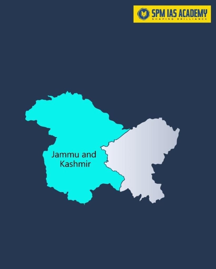
- Formation and Area:
- Jammu and Kashmir is the largest Union Territory (UT) in India by area, covering approximately 42,241 sq. km (16,309 sq. miles).
- The Jammu and Kashmir Reorganisation Act, 2019 formed the present Union Territory of Jammu and Kashmir. The act divided the former state of Jammu and Kashmir into two UTs — Jammu and Kashmir and Ladakh.
- Administrative Details:
- Capitals:
- Srinagar – Summer Capital
- Jammu – Winter Capital
- Administrative Divisions:
- 20 districts, 207 tehsils, 49 sub-divisions, and 520 nayabats.
- Capitals:
- Demographics (2025 Estimates):
- Population: 1.38 Crore as of July 1, 2025.
- Sex Ratio: 889 females per 1,000 males
- Child Sex Ratio: 862 girls per 1,000 boys
- Literacy Rate: 67.16% overall
- Male: 76.75%
- Female: 56.43%
- Topography:
- Dominated by Himalayas in the north and the Pir Panjal Range in the south.
- Encompasses beautiful valleys such as the Kashmir Valley and the Jammu Valley.
- Major rivers: Jhelum, Chenab, and Ravi.
- Climate:
- Temperate climate with four distinct seasons.
- Temperature varies from -2°C in winter to 35°C in summer.
- Winters are snowy in higher altitudes, while summers are mild and pleasant.
- Biodiversity:
- Rich in flora and fauna, with coniferous forests and alpine meadows.
- Notable wildlife includes the Himalayan black bear, snow leopard, and Markhor (mountain goat).
- Home to several national parks and wildlife sanctuaries.
Largest Union Territory in India By Population – Union Territory of Delhi:
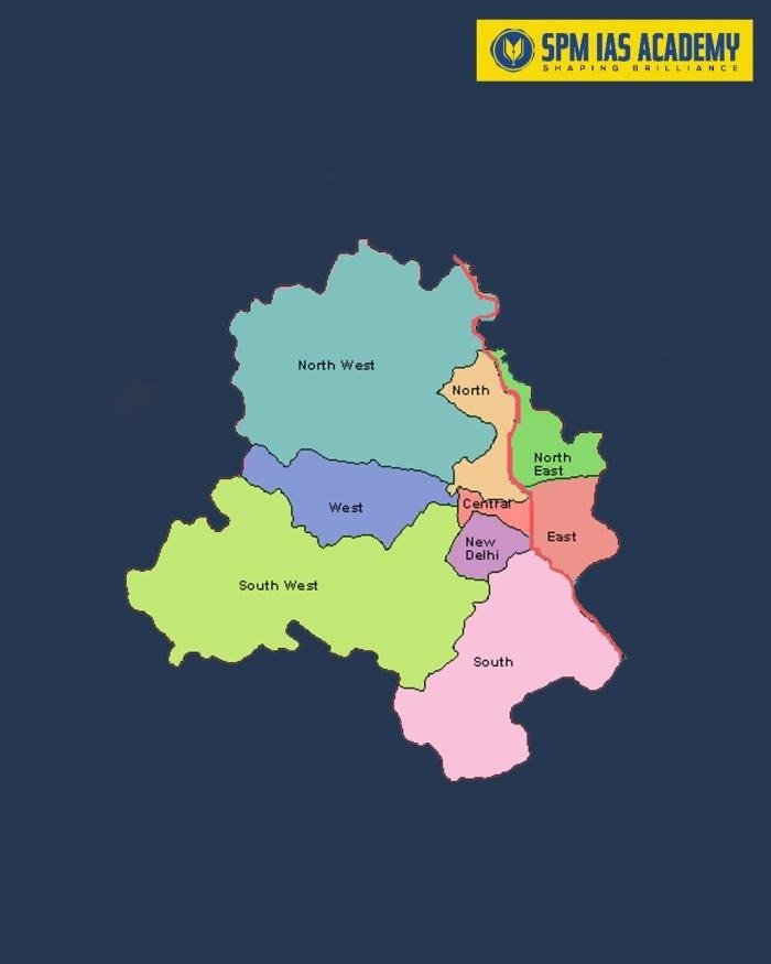
- Delhi is the largest Union Territory by population.
- Population: as of Census, 2011, its population is 16,787,941.
- It is the National Capital Territory (NCT) with a unique administrative status.
- Administrative Status:
- Officially known as the National Capital Territory (NCT) of Delhi, it is a Union Territory with a legislative assembly under Article 239AA of the Indian Constitution.
- It functions as a special UT, sharing powers between the Central Government and the Delhi Government.
- Area and Location:
- Area: Approximately 1,483 sq. km, making it one of the smallest Union Territories in India.
- It is located in northern India, bordered by Haryana on three sides and Uttar Pradesh on the east (across the Yamuna River).
- Population:
- Population (2021 estimate): Around 2 crore (20 million), the most populous Union Territory in India.
- It has a high population density and a literacy rate of about 88%, reflecting its urban and economic importance.
- Economy and Significance:
- Delhi is India’s political, administrative, and commercial hub, hosting all three branches of the Indian Government — the Executive, Legislature, and Judiciary.
- It has a diversified economy, driven by services, IT, trade, transport, and real estate.
- Per capita income: 4,61,910 (2023-24).
- Geography and Climate:
- Lies along the Yamuna River with an arid to semi-arid climate — hot summers, monsoon rains, and cool winters.
- Major landmarks include the Red Fort, India Gate, Qutub Minar, Rashtrapati Bhavan, and Lotus Temple, making it a major tourist and cultural center.
- Relevance for UPSC:
- Polity: Article 239-241, special status of Delhi (Article 239AA) and J&K (Article 239AB), role of Lieutenant Governor vs. Chief Minister.
- Governance: Administration of UTs, central control vs. local representation.
- Current Affairs: Reorganization of J&K and Ladakh in 2019.
- Union Territories, Article 239AA, Lieutenant Governor, NCT of Delhi, J&K Reorganisation Act 2019.
Additional Facts:
Smallest State in India by Area (2025): Goa
- Area and Location:
- Goa is the smallest state in India by area, covering 3,702 sq. km.
- Situated on the west coast of India, it is bordered by:
- Maharashtra on the North
- Karnataka on East and South
- Arabian Sea on the West
- Historical Background:
- Goa got liberation on 19 December 1961 from Portuguese rule.
- Statehood: Became a separate state on 30 May 1987 after being part of the Union Territory of Goa, Daman & Diu.
- Known historically as “Golden Goa” and “Rome of the East” due to its cultural richness and architectural grandeur.
- Administrative Divisions:
- Goa is divided into two districts:
- North Goa
- South Goa
- Capital: Panaji (Panjim) serves as the state capital.
- Goa is divided into two districts:
- Topography:
- Lies along the South-western coast of India with about 160 km of coastline.
- Known for its sandy beaches, estuaries, river mouths, and rocky promontories.
- The Western Ghats run along its eastern border, adding ecological diversity.
- Rivers:
- Major rivers include:
- Mandovi River
- Zuari River
- Chapora River
- Terekhol River
- Major rivers include:
Conclusion:
In conclusion, understanding the largest state and Union Territory of India by area and population is essential for every UPSC, APSC, and State PCS aspirant. It reflects India’s geographical and demographic diversity. Rajasthan stands as the largest state by area, showcasing vast deserts, plateaus, and cultural heritage, while Uttar Pradesh holds the distinction of being the most populous state, highlighting India’s demographic strength and developmental challenges.
Among Union Territories, Jammu and Kashmir is the largest Union Territory by area, whereas Delhi (NCT) remains the most populous Union Territory, serving as the nation’s political and administrative heart.
These distinctions are not just statistical facts but also help aspirants understand India’s spatial distribution, population dynamics, and regional planning needs.
Sources:
- https://censusofindia.net/topfacts/state/largesarea.html
- https://statisticstimes.com/geography/india/indian-states-area.php
FAQs:
Rajasthan is the largest state in India by area, covering 342,239 sq. km, with Jaipur as its capital.
Uttar Pradesh is the largest state by population, with a population of over 24 crore (as of 2025), accounting for about 17% of India’s total population.
Jammu and Kashmir is the largest Union Territory by area, spanning 42,241 sq. km, formed under the Jammu and Kashmir Reorganisation Act, 2019.
The National Capital Territory (NCT) of Delhi is the most populous UT, with a population of over 2.23 crore.
Goa is the smallest state in India, covering 3,702 sq. km, known for its beaches, tourism, and Indo-Portuguese heritage.