If you are preparing for the UPSC Civil Services Examination or the APSC Combined Competitive Examination, understanding world geography is important. Gulfs are important geographical features that significantly impact global trade, geopolitics, and climate patterns.
Hence, in this article, we will discuss the major gulfs of the world. It includes a list of the key gulfs of the world and explains their importance. Moreover, this information will help you to prepare thoroughly for the UPSC and other state PSC exams for geography portion. .
What are Gulfs?
A gulf is a significant body of saltwater that is partially surrounded by land, connecting to a sea or ocean. Typically larger and more deeply indented than bays, gulfs vary in size, shape, and depth. Their nearly complete enclosure by land makes them ideal for serving as excellent harbours. Many crucial trading centres are located on gulfs, highlighting their importance as major shipping routes for commerce.
In addition to facilitating trade, the important gulfs of the world provide rich habitats for marine life and offer recreational opportunities for fishing and tourism. The unique shapes and locations of gulfs also play a crucial role in influencing the climate and geography of the surrounding areas, making them essential features of the world’s coastal landscapes.
- The world’s largest gulf is the Gulf of Mexico.
- Examples of other gulfs include the Gulf of California, the Gulf of Aden (between the Red Sea and the Arabian Sea), and the Persian Gulf (between Saudi Arabia and Iran).
- The Persian Gulf is important with respect to world energy because petroleum is transported through its waters in oil tankers.
What is the Importance of Gulfs?
Further, gulfs function as important elements which shape environmental ecosystems and business operations on Earth by connecting trade routes, protecting coastal settlements, and supporting abundant marine biodiversity.
The importance of gulfs extends far beyond their geographical definition. The major gulfs of the world are important for several reasons:
- Trade and Shipping: Multiple major gulfs function as essential maritime corridors which enable worldwide commerce and trade operations. In addition, the protected waters of the Gulf contain important ports which function as entry points for material shipments.
- Economic Hubs: Besides, the areas along the Gulf coastlines contain abundant natural resources that fuel the creation of significant industrial and economic centres. The fishing industry represents a vital economic sector throughout numerous Gulf regions.
- Geopolitical Significance: The strategic position and resource abundance of the Gulf makes them targets for geopolitical power struggles and conflicts. Also, the ability to control vital gulfs leads to substantial authority and dominance in the international arena.
- Biodiversity and Ecosystems: Gulfs create environments that sustain a variety of marine life which includes coral reefs and mangrove forests and numerous fish species. The conservation of marine biodiversity depends on proper management of these areas.
- Cultural and Historical Significance: Numerous civilisations emerged near gulfs where they used these waters for food, trade and protection while creating valuable cultural heritage.
List of the Major Gulfs of the World
The Earth has many different landscapes, including important bodies of water like gulfs. These gulfs are vital because they support marine life, help regulate the climate, and are important for human activities, hence making them an important topic for geography notes for UPSC as well as other state PSC exams.
Now, let us explore some of the major gulfs of the world that are particularly relevant for your UPSC and APSC examinations.
1. Gulf of Mexico
- This gulf stands as the largest oceanic depression across the globe.
- The United States shares its border with Mexico, while Cuba stands as an island nation that forms part of its boundaries.
- The coastline stretches across approximately 5,000 kilometres.
2. Gulf of Oman
- The Gulf of Oman serves as a link between the Arabian Sea and the Strait of Hormuz before reaching the Persian Gulf.
- The Gulf’s northern boundary reaches Pakistan and Iran, while Oman and the United Arab Emirates stand along its southern and western borders, respectively.
3. Gulf of Aden
- The Gulf of Aden sits within the Arabian Sea between the Yemeni coast and the Somali coastline.
- It links to the Red Sea via the Bab-el-Mandeb strait, which serves as its northwestern connection.
- Additionally, this waterway forms a vital part of the Suez Canal, which connects the Mediterranean Sea to the Arabian Sea in the Indian Ocean.
4. Persian Gulf
- Western Asia contains this body of water between the Iranian landmass and the Arabian Peninsula.
- Notably, the Persian Gulf serves as an extension of the Indian Ocean (Gulf of Oman), which connects through the Strait of Hormuz.
- Further, the Persian Gulf coastline consists of eight countries starting from the north and moving clockwise as: Iran, Oman, United Arab Emirates, Saudi Arabia, Qatar, Bahrain, Kuwait and Iraq.
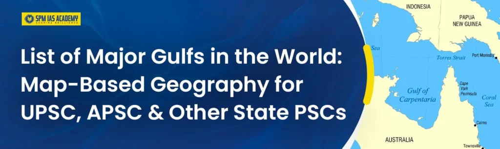
5. Gulf of Carpentaria
- A large shallow sea exists in Western Australia, which is surrounded by the northern Australian landmass on three sides, while the Arafura Sea defines its northern boundary. The Arafura Sea exists as the oceanic region between the Australian mainland and the island of New Guinea.
6. Gulf of Bothnia
- The Gulf of Bothnia represents a segment of the Baltic Sea that separates Sweden from Finland.
- This Baltic Sea arm extends to the northernmost point.
7. Gulf of Riga
- The Gulf of Riga serves as a Baltic Sea bay which separates Latvia from Estonia.
- The Irbe Strait connects the Gulf of Riga to the Baltic Sea.
8. Gulf of Alaska
- The Gulf of Alaska serves as an arm of the Pacific Ocean.
- In fact, the entire shoreline of the Gulf is a rugged combination of forest, mountain, and a number of tidewater glaciers.
- Notably, Alaska’s largest glaciers, the Malaspina Glacier and Bering Glacier, spill out onto the coastal plain along the Gulf of Alaska.
9. Gulf of Finland
- The Gulf of Finland is located between the southern coast of Finland and the northern coast of Estonia in the Baltic Sea.
- Extending eastward, it reaches all the way to Saint Petersburg in Russia, where the Neva River drains into it.
- Importantly, the eastern sections of the Gulf of Finland fall under Russian territory. Covering an area of approximately 30,000 km², the Gulf stretches about 400 km from the Hanko Peninsula to Saint Petersburg.
10. Gulf of Mannar
- The Gulf of Mannar is situated between the southeastern part of India and the western coastline of Sri Lanka.
- The Gulf of Mannar represents a wide shallow bay which forms part of the Laccadive Sea in the Indian Ocean.
- Ramsethu or Adam’s Bridge, including Mannar Island, divides the Gulf of Mannar from Palk Bay, which exists northward between India and Sri Lanka.
- The Gulf of Mannar Marine National Park was established in 1986 when 21 islets along the Tamil Nadu coast between Thoothukudi and Dhanushkodi were designated as protected territory. The park, along with its surrounding 10-kilometre buffer zone, received Biosphere Reserve status in 1989.
11. Gulf of Martaban
- The Gulf of Martaban or the Gulf of Mottama represents an arm of the Andaman Sea located in southern Burma. The gulf derives its name from the port city of Mottama, which was previously known as Martaban. The Sittaung, Salween, and Yangon rivers flow into this body of water.
12. Gulf of Panama
- The Gulf of Panama is a Pacific Ocean gulf which sits close to the southern shoreline of Panama.
- Its maximum width reaches 250 kilometres, while its deepest point measures 220 metres, and its surface area reaches 2,400 square kilometres.
- The Panama Canal links the Gulf of Panama to the Caribbean Sea and the Atlantic Ocean.
13. Gulf of Suez
- The Gulf of Suez is a gulf which extends from the northern end of the Red Sea towards the west of the Sinai Peninsula. The smaller Gulf of Aqaba sits to the east of the Sinai Peninsula.
14. Gulf of Thailand
- The Gulf of Thailand, formerly known as the Gulf of Siam, is bordered by Cambodia, Thailand, and Vietnam. At its northernmost point, the Bay of Bangkok lies at the mouth of the Chao Phraya River, serving as a key geographical feature.
- The gulf extends across approximately 320,000 square kilometres.
15. Gulf of Gabes
- The Gulf of Gabes is a Tunisian gulf located on the eastern coast of the Mediterranean Sea, which borders North Africa.
- The Gulf borders Libya and Tunisia.
16. Gulf of Saint Lawrence
- The Gulf of Saint Lawrence represents the biggest estuary worldwide.
- Through the Saint Lawrence River, the North American Great Lakes discharge their water into the Atlantic Ocean via this gulf.
- The Gulf of Saint Lawrence receives its northern border from the Labrador Peninsula and Quebec. At the same time, its eastern boundary consists of Newfoundland Island, and its southern border includes the Nova Scotia peninsula and Cape Breton Island, and its western border consists of the Gaspe Peninsula, New Brunswick and Quebec.
17. Gulf of Aqaba
- The Gulf of Aqaba or Gulf of Eilat exists as a substantial gulf which extends along the northern Red Sea shore between the Sinai Peninsula and the Arabian mainland.
- Four nations, including Egypt, Israel, Jordan, and Saudi Arabia, share the coastline of this gulf.
- The Gulf of Aqaba stands as a top-ranking diving destination across the world.
18. Amundsen Gulf
- The Amundsen Gulf exists as a gulf in the Canadian Northwest Territories, which separates Banks Island and Victoria Island from the mainland.
- The gulf extends 400 kilometres from end to end.
- The Norwegian explorer Roald Amundsen was the first to explore the Amundsen Gulf.
19. Gulf of Tonkin
- A gulf located in the northwestern part of the South China Sea exists as the Gulf of Tonkin, which borders the coasts of Tonkin and South China. (b) The Red River enters this gulf and its major ports are Ben Thuy and Haiphong within northern Vietnam and Beihai (Pakhoi) in China.
20. Gulf of Kutch
- The coastline of Gujarat’s Kutch region contains this area. This area serves as a western Indian coastline Arabian Sea inlet. The Kutch Gulf reaches its deepest point at 402 feet, spanning between 150 and 160 kilometres in width. The Gulf of Kutch will become home to the first Coral garden installation.
21. Gulf of Khambhat
- This area extends from the Arabian Sea as a coastal extension of the western Indian coast at Gujarat’s Kathiawar region to the south of the Gulf of Kutch. The Gulf of Khambhat receives the major eastward flowing rivers of India, the Narmada and Tapti. The Gulf of Cambay serves as an alternate name for this area.
22. Gulf of Guinea
- The Gulf of Guinea represents the north-easternmost section of the tropical Atlantic Ocean.
- The Equator and Prime Meridian intersect at zero degrees latitude and longitude in this gulf.
- The Niger and Volta rivers, along with numerous others, empty their waters into the Gulf of Guinea.
a. Piracy in the Gulf of Guinea
- The Gulf of Guinea piracy issues affect multiple West African nations, as well as the international community, which creates global concern.
- Armed criminal groups that operate in these waters use violent tactics to rob oil cargo from ships.
- The International Maritime Bureau (IMB) has declared the Gulf of Guinea the most perilous maritime zone for shipping operations in its recent assessment.
- The IMB reports that 73 per cent of all sea kidnappings and 92 per cent of hostage-takings take place in this region, with pirates frequently demanding ransom for captured sailors.
b. Causes of Piracy in the Gulf of Guinea
- Youth unemployment and widespread poverty are among the primary factors leading to piracy in the Gulf of Guinea. During a meeting about a regional mission, the UN Security Council recognised that ‘any complete anti-piracy approach needs to address fundamental reasons, including extensive youth unemployment.
- Besides, severe political disputes serve as an additional cause for piracy growth throughout the region and directly promote piracy operations in certain situations.
- Another key point is that the Movement for the Emancipation of the Niger Delta operates in southern Nigeria, where it openly declares its intention to take and sell oil products to reclaim wealth and express its protest through this action.
- Additionally, the governments of Cameroon and Nigeria have been engaged in a significant dispute regarding the Bakassi Peninsula that led to reduced government collaboration, which weakened their ability to control illegal operations.
- Corruption stands as a significant factor that mainly affects the Nigerian situation. Various reports indicate that certain local authorities provide protection to persons who conduct attacks on oil company installations and personnel, mainly operating in the Niger Delta region.
23. Gulf of Cadiz
- The Gulf of Cádiz lies between the southern mainland and Cape Trafalgar at the western entrance to the Strait of Gibraltar in the Atlantic Ocean.
- The ocean here receives two major rivers, which are the Guadalquivir and the Guadiana.
24. Gulf of California
- This water body divides the Mexican mainland from the Baja California Peninsula within the Pacific Ocean.
- This body of water goes by the name Sea of Cortez.
- The Gulf of Cortez hosts one of the world’s most diverse marine ecosystems because more than 5000 microinvertebrate species inhabit its waters.
25. Gulf of Maine
- This Atlantic Ocean gulf extends across the eastern coastline of North America.
- The Gulf contains the full coastal areas of New Hampshire and Maine, along with Massachusetts north of Cape Cod, and the southern and western coastlines of New Brunswick and Nova Scotia in Canada.
What is the Difference Between Gulfs and Bays?
A gulf constitutes a large water body which exists between land masses and features a slim opening through a strait. A bay represents a sizable water area which land encircles but remains less enclosed than a gulf.
The table below shows the difference between the gulfs and bays:
| Gulfs | Bays |
| A gulf is a portion of the ocean that penetrates land. | A bay is a body of water partly surrounded by land. |
| Gulfs vary greatly in size, shape, and depth. They are generally larger and more deeply indented than bays. | A bay is usually smaller and less enclosed than a gulf. |
| Gulfs are sometimes connected to the ocean by narrow passages of water called straits. They can also have wide openings and are sometimes indistinguishable from larger bodies of water. | The mouth of the bay is typically wider than that of a gulf, where it meets the ocean or lake. |
| Example: Persian Gulf | Example: Hudson Bay, Canada |
Guantánamo Bay
- Guantánamo Bay functions as a protective cove located in the Caribbean Sea.
- During the Spanish-American War in 1898, the United States obtained control of the outer harbour of Guantánamo Bay.
- Through an agreement signed with Cuba in 1903, the United States obtained the right to maintain a naval base at Guantánamo Bay.
- In 1934, a treaty reaffirmed the U.S. right to lease the site. The treaty gave the United States a perpetual lease on Guantánamo Bay.
- The most infamous Guantánamo Bay prison is here.
Strategies for UPSC and APSC: Incorporating the Gulf Knowledge
If you are a civil service aspirant, you can use the following strategies while studying the major gulfs of the world:
1. Map Work: Make it a habit to use political and physical maps for navigation. Identify every Gulf location together with its surrounding nations and analyse the main marine passageways. Visual learning stands as an essential element.
2. Interlinkages: Study how gulfs relate to larger geographical patterns such as ocean currents and climate zones, as well as geopolitical aspects, including trade conflicts and security problems.
3. Current Affairs: Make sure you understand the latest developments which affect these gulfs. New discoveries along with political tensions and environmental concerns regarding these gulfs become probable examination topics.
4. Comparative Analysis: Analyse different gulfs by examining their economic value and environmental issues, along with their strategic value.
5. Note-Making: Your notes should follow an orderly structure, which can be based on either continental regions or economic, environmental and strategic factors.
Conclusion
The major gulfs of the world represent more than simple map indications because they serve as lively, prosperous economic centres which shape worldwide forces. The Persian Gulf, along with the Gulf of Mexico and the Gulf of Aden, functions as a key trade route for worldwide oil movement while containing substantial natural resource reserves. The marine ecosystems within these gulfs play important roles in maintaining biodiversity while affecting local climatic conditions, thus highlighting the importance of gulfs.
If you’re an aspiring UPSC or APSC candidate, understanding the important gulfs of the world and grasping their importance is a key part of your journey in mastering world geography UPSC.
Frequently Asked Questions
Ans: Gulfs are large coastal indentations of a sea or ocean, often partly enclosed by land and generally larger than bays.
Ans: The five largest gulfs of the world are:
Gulf of Mexico: The largest, bordering the U.S., Mexico, and Cuba.
Gulf of Guinea: Located off the western coast of Africa.
Gulf of Alaska: Found along the southern coast of Alaska, USA.
Hudson Bay: A large gulf within northeastern Canada.
Persian Gulf: Between the Arabian Peninsula and Iran, it is vital for oil transport.
Ans: The Persian Gulf is the most famous gulf in the world due to its oil reserves.
Ans: The Gulf of California, also known as the Sea of Cortés, is the smallest gulf.
Ans: The Gulf of Mexico is generally considered the longest gulf.