
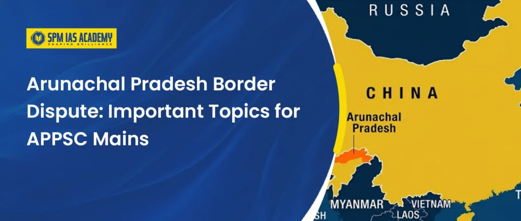
The Arunachal Pradesh Border Dispute is an important topic for the APPSC Mains Examination. Geographically, Arunachal Pradesh shares international borders with China, Bhutan, and Myanmar, while also having an interstate border dispute with Assam. Therefore, this topic connects geography, history, governance, internal security, and international relations. It is highly relevant for aspirants preparing through APSC coaching centers, as questions related to border disputes, Northeast India, and India’s internal and external security frequently appear in APSC and UPSC examinations.
For APPSC Mains, you should focus on the McMahon Line, China’s territorial claims, the 1962 India–China War, and the strategic importance of Tawang. You should also study border infrastructure, interstate boundary settlements, and recent developments along the Line of Actual Control
What is the Arunachal Pradesh Border Dispute?
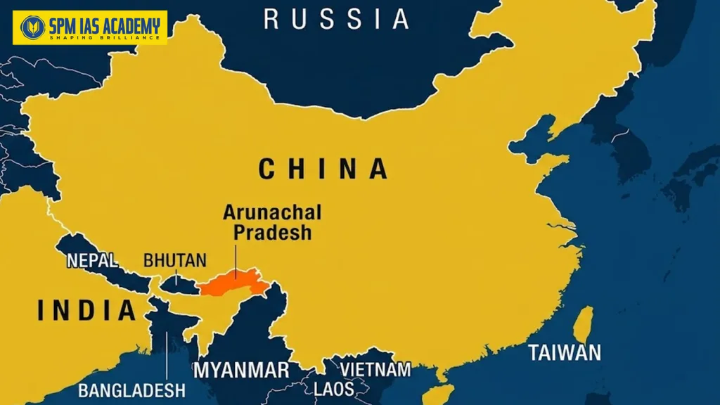
Arunachal Pradesh is located in the north-eastern part of India. It shares international borders with China to the north, Bhutan to the west, and Myanmar to the east. Within India, it shares state boundaries with Assam and Nagaland. Due to its strategic location, Arunachal Pradesh is significant from geographical, political, and security perspectives. Understanding its location and boundaries is essential for APSC exam preparation, as questions related to the geography of Northeast India frequently appear in APSC, UPSC, and other competitive examinations.boundaries with Assam and Nagaland. The major dispute is around the India–China boundary.
International Border Issue
The international side of the Arunachal Pradesh Border Dispute mainly involves China. Arunachal Pradesh is an integral part of India. However, China claims a large part of the state and describes it as part of “South Tibet.” India has repeatedly rejected this claim as baseless and bogus.
India and China have different views about the boundary in Arunachal Pradesh. India follows the McMahon Line as the legal boundary in this sector. However, China does not accept it and claims Arunachal Pradesh, particularly Tawang, as part of “South Tibet.” India firmly rejects this claim.
Arunachal Pradesh is a full-fledged state of India, with an elected government and constitutional representation. Therefore, India considers the entire state an integral and inalienable part of the country. India continues to protect its territorial integrity while supporting dialogue for a peaceful settlement of the boundary issue.
International Borders of Arunachal Pradesh
Arunachal Pradesh occupies a strategically significant position on India’s north-eastern frontier. It shares international borders with China to the north and northeast, Bhutan to the west, and Myanmar to the east and southeast. According to official sources, the state shares approximately 1,126 km of border with China, 217 km with Bhutan, and 520 km with Myanmar. These international boundaries have a major influence on the state’s security, connectivity, trade, border management, and the livelihoods of local communities, making Arunachal Pradesh one of India’s most strategically important states. This topic is highly relevant for aspirants preparing through UPSC coaching in North East India, as questions on the geography, international borders, and strategic importance of Northeast India are frequently asked in UPSC and APSC examinations.
Border with China
The China border is the longest and most sensitive international border of Arunachal Pradesh. Moreover, the overall Indo-China border is considered the longest land boundary of the world. The Line of Actual Control (LAC) serves as the working boundary. However, China has continued to disregard the LAC and claim parts of Arunachal Pradesh.
India follows the McMahon Line as the boundary in this sector. China rejects it and claims large parts of Arunachal Pradesh, especially Tawang. India firmly rejects this claim and considers the entire state an integral part of the country.
Moreover, places such as Tawang, Bum La, Yangtse, Kibithu and Walong hold great strategic importance. The border also witnessed major fighting during the 1962 India–China War. Therefore, India continues to strengthen roads, bridges, communication networks and defence facilities in this region.
Border with Bhutan
Arunachal Pradesh shares its western border with Bhutan. Unlike the India–China border, the India–Bhutan border is peaceful and characterized by friendly diplomatic relations. This boundary passes through the mountainous and forested regions of western Arunachal Pradesh and plays an important role in regional connectivity, border management, and cultural exchanges. Understanding these international boundaries is essential for aspirants preparing through APSC coaching in Assam, as topics related to the geography and strategic importance of Northeast India are frequently asked in APSC and UPSC examinations.
This boundary is important because it lies close to Tawang and the eastern Himalayan region. India and Bhutan maintain close diplomatic and security relations. Furthermore, communities on both sides share cultural, religious and economic connections. Protecting forests, improving border roads and preventing illegal cross-border activities remain important for both countries.
Border with Myanmar
Arunachal Pradesh shares its eastern and southeastern border with Myanmar. Much of this boundary passes through remote hills and thick forests. Consequently, monitoring movement across the border can be difficult.
The Pangsau Pass is an important geographical point on this border. It lies along the historic Stilwell Road, which connected India with Myanmar and China during the Second World War. The border also has cultural importance because several tribal communities have social and ethnic links across both sides.
At the same time, the difficult terrain is prone to illegal movement, arms trafficking, drug trafficking and other cross-border crimes. Therefore, better roads, stronger administration and cooperation with local communities are essential. The Myanmar border is important for India’s Act East Policy, which aims to improve links between Northeast India and Southeast Asia.
China–Arunachal Pradesh Border Dispute
The China–Arunachal Pradesh border dispute arises from two different positions. India recognises the McMahon Line, drawn during the 1914 Simla Convention, as the boundary in the eastern sector. China rejects this boundary and claims almost all of Arunachal Pradesh as “South Tibet,”. India firmly rejects this claim. For India, Arunachal Pradesh is not disputed territory. It is a full-fledged Indian state and an integral and inalienable part of the country.
Historically, the disagreement became more serious during the 1962 India–China War, when Chinese forces advanced into areas such as Tawang and Walong before withdrawing. Today, the Line of Actual Control (LAC) functions as the working boundary. However, both countries interpret its location differently at certain points. As a result, their patrols sometimes meet face-to-face, as seen in Galwan Valley in 2020.
Moreover, Tawang holds military, historical, and religious importance because it lies near the border and houses the famous Tawang Monastery. China has also renamed places in Arunachal Pradesh to support its territorial claim. However, India has stated that invented names cannot change historical or administrative reality. Therefore, India is strengthening border roads, tunnels, villages and surveillance through initiatives such as the Vibrant Village Programme while continuing diplomatic and military talks with China.
What is the McMahon Line and its Historical Background?
The McMahon Line forms the historical basis of the Arunachal Pradesh Border Dispute between India and China. Its history can be understood through the following points:
The boundary was unclear before 1914: During British rule, the Himalayan boundary between India and Tibet had not been clearly marked. This created administrative and security concerns in the eastern frontier.
The Simla Conference was held: Representatives of British India, Tibet and China met at Simla between 1913 and 1914. The conference aimed to discuss Tibet’s status and settle boundary-related questions.
Henry McMahon proposed the boundary: Sir Henry McMahon, the Foreign Secretary of British India, represented the British government. He proposed a boundary between British India and Tibet. Therefore, the line was later named the McMahon Line.
The boundary was drawn on a map: The proposed line broadly followed the Himalayan watershed. It ran from the eastern border of Bhutan towards the frontier of present-day Myanmar. Importantly, it placed Tawang and most of present-day Arunachal Pradesh on the Indian side.
British India and Tibet accepted the line: The British and Tibetan representatives accepted the boundary through an exchange of maps. However, the Chinese representative did not sign the final Simla Convention. China mainly objected to the agreement over Tibet’s status and later rejected the McMahon Line.
India inherited the boundary: After gaining independence in 1947, India accepted the McMahon Line as its boundary in the eastern sector. Arunachal Pradesh was then administered as part of India, initially under the North-East Frontier Agency, or NEFA.
China continued to reject it: China does not recognise the McMahon Line. It falsely claims most of Arunachal Pradesh. India firmly rejects this claim and considers Arunachal Pradesh an integral part of the country.
The dispute contributed to the 1962 war: During the 1962 India–China War, Chinese forces crossed the McMahon Line and advanced into areas including Tawang and Walong. However, they later announced a ceasefire and withdrew from much of the occupied territory in the eastern sector.
Strategic Importance of Arunachal Pradesh for India
The Arunachal Pradesh Border Dispute increases the state’s strategic importance for India because of its location and international borders. It shares borders with China, Bhutan and Myanmar. Therefore, the state affects India’s national security, water security and relations with neighbouring countries.
India’s Shield in the Eastern Himalayas: First, Arunachal Pradesh protects India’s Eastern Himalayan Frontier. Its mountains, valleys and passes form a natural defence barrier. Places such as Tawang, Bum La, Se La, Kibithu and Walong are especially important for national security.
India’s Position Along the Eastern LAC: A large part of the eastern sector of the Line of Actual Control, or LAC, lies along Arunachal Pradesh. India follows the McMahon Line as the boundary in this region. However, China rejects it and makes claims over Indian territory.
Strategic Importance of Tawang: Tawang holds a special place in India’s border strategy. It lies close to the LAC and provides access to important Himalayan routes. The area also witnessed major fighting during the 1962 India–China War.
Furthermore, Tawang has deep cultural and religious importance because it houses the historic Tawang Monastery. Although China uses Tibet-related arguments to support its claim, India maintains complete administrative and constitutional authority over Tawang.
Importance of Arunachal’s Rivers: Arunachal Pradesh is home to major rivers such as the Siang, Subansiri, Kameng, Dibang and Lohit. These rivers support agriculture, hydropower, biodiversity and daily life across Arunachal Pradesh and Assam.
The Siang enters India through Arunachal Pradesh and later becomes a major part of the Brahmaputra system. Therefore, monitoring upstream activities in Tibet is important for India’s water and environmental security.
Stronger Connectivity for Security and Development: Arunachal Pradesh has mountains, thick forests and heavy rainfall. These conditions make road construction difficult. However, India has continued to improve border connectivity despite these challenges.
Roads, bridges, tunnels and advanced landing grounds help the armed forces reach border areas quickly. For example, the Sela Tunnel improves year-round access towards Tawang. At the same time, such projects provide local people with better access to healthcare, education and markets.
Protection of the Wider Northeast: The Siliguri Corridor in West Bengal connects mainland India with the Northeast. Although Arunachal Pradesh does not directly touch this corridor, its security affects the stability of the entire region.
Therefore, India is developing more roads, railways, and air links across the Northeast. These alternative routes improve the movement of people and supplies. They also reduce excessive dependence on one narrow land connection.
Role in India’s Act East Policy: Arunachal Pradesh shares an international border with Myanmar. As a result, it can support India’s Act East Policy, which aims to deepen relations with Southeast Asia.
The historic Pangsau Pass and Stilwell Road show the region’s old links with Myanmar. In the future, better roads, peaceful borders and regulated trade can turn Arunachal Pradesh into an important link between India and Southeast Asia.
Steps Taken by India to Strengthen Border Security
India has taken several measures to manage the Arunachal Pradesh Border Dispute and protect its eastern frontier.
Deployment of security forces: First, the ITBP guards the India–China border through regular patrols and Border Outposts. Meanwhile, the Indian Army remains prepared to respond to larger threats.
Construction of border roads: Secondly, the Border Roads Organisation builds roads in remote areas. These roads support faster troop movement and connect local people with hospitals, schools and markets.
Vibrant Villages Programme: Under this programme, 455 villages in Arunachal Pradesh were selected for development. Better roads, electricity, communication and livelihoods strengthen India’s presence near the border.
Coordination between agencies: The Army, ITBP, BRO, local police and civil administration share information and plan together. This coordination improves India’s response to security incidents and natural disasters.
Dialogue with China: Finally, India holds diplomatic and military talks with China to manage border tensions. However, it continues to protect its territorial integrity and national interests.
Support for local communities: India is promoting healthcare, education, tourism and employment in border areas. As a result, people have stronger reasons to remain in their villages.
All-weather tunnels: Moreover, the Sela and Nechiphu tunnels improve year-round connectivity towards Tawang. They help the armed forces move personnel and supplies even during difficult weather.
Conclusion
In conclusion, the Arunachal Pradesh border dispute is closely linked to India’s sovereignty, national security and regional development. Therefore, India must continue strengthening border infrastructure, supporting local communities and maintaining military preparedness. At the same time, peaceful dialogue with China remains necessary. Thus, a secure and developed Arunachal Pradesh will strengthen both India’s eastern frontier and the wider Northeast.
Frequently Asked Questions
The dispute mainly exists because India and China do not agree on the boundary in the eastern sector. India recognises the McMahon Line and considers Arunachal Pradesh an integral part of the country. However, China rejects this boundary and claims much of the state, particularly Tawang.
Arunachal Pradesh protects India’s eastern frontier and contains important routes, rivers and mountain passes. Therefore, India strengthens roads, tunnels, surveillance, military preparedness and border villages across the state. These measures improve national security while also giving local communities better access to healthcare, education, communication and livelihood opportunities.

Behind every article at SPM IAS Academy is a team of skilled content writers and subject experts committed to making preparation easier for aspirants. From answering common doubts to breaking down complex issues and current affairs, we create content that is accurate, easy to understand, and directly useful for UPSC, APSC, and other competitive exams.