
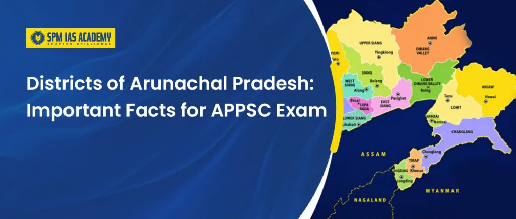
Geography questions in the APPSC examination frequently test candidates on specific facts related to the districts of Arunachal Pradesh, including boundary-sharing countries, largest and smallest districts by area, population extremes, newly created districts, and unique administrative features. If you are preparing for the APPSC Combined Competitive Examination or any other state-level examination in Arunachal Pradesh, mastering these factual details can provide a significant scoring advantage. Aspirants studying at an Assam Civil Service Academy should also focus on this topic, as the geography and administrative structure of Northeast India are commonly covered in APSC, APPSC, and UPSC examinations.
This article covers everything an APPSC aspirant needs to know about the districts of Arunachal Pradesh, from the 2024 additions to international border districts, area and population extremes, and the unique district facts that frequently appear in exam questions.
How Many Districts Does Arunachal Pradesh Have in 2026?
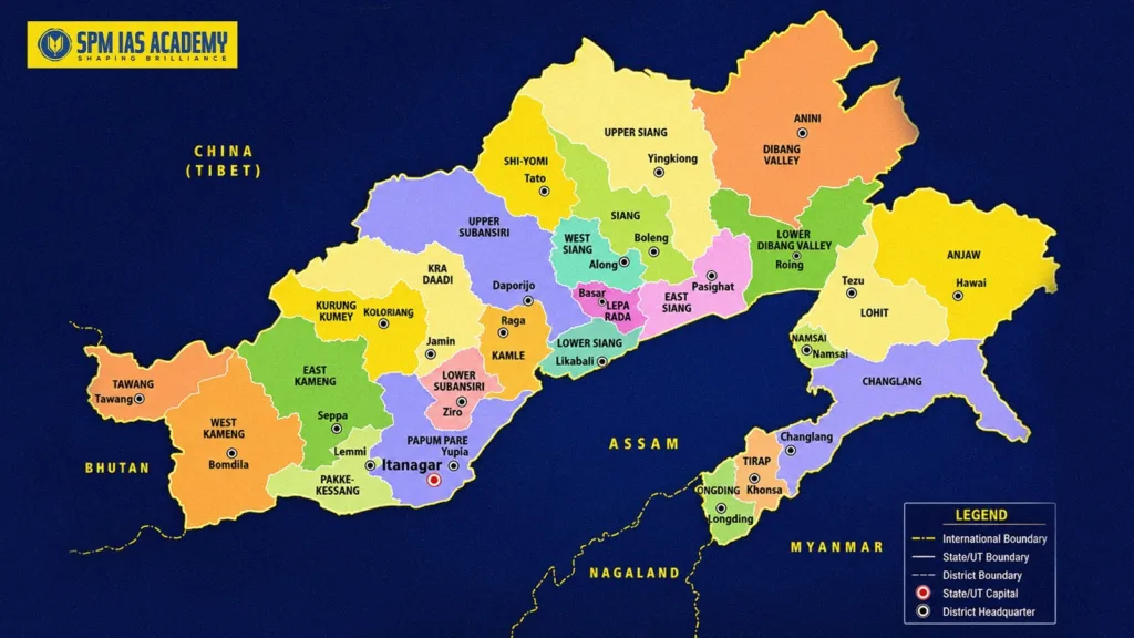
As of June 2026, Arunachal Pradesh has a total of 28 administrative districts. The state previously had 26 districts, and in early 2024, the state government officially added two new districts, Keyi Panyor and Bichom, bringing the total to 28.
The districts of Arunachal Pradesh share internal borders with Assam and Nagaland to the south. The state holds significant strategic importance because of its international boundaries, it is the only state in Northeast India that shares international borders with three different countries: Bhutan, China, and Myanmar. This three-country border situation makes the geographic knowledge of individual district locations essential for both exam performance and understanding the strategic realities of the region.
What Are the Two Newly Formed Districts of Arunachal Pradesh in 2024?
The addition of Keyi Panyor and Bichom in March 2024 is a high-priority topic for any APPSC aspirant studying the districts of Arunachal Pradesh. Here is the comparative breakdown of both:
| Feature | Keyi Panyor (27th District) | Bichom (28th District) |
| Date of Creation | March 2024 | March 2024 |
| Carved Out From | Lower Subansiri district | East Kameng and West Kameng districts |
| District Headquarters | Yachuli (Ter Gapin-Sam Sath) | Napangphung |
| Dominant Community | Nyishi tribe | Miji, Aka, Sajolang, and Puroik tribes |
Keyi Panyor district was carved out of Lower Subansiri district to improve administrative efficiency and accelerate development in the Yachuli basin, while reducing the administrative burden on Ziro. The Nyishi tribe is the dominant community in the district and plays an important role in its cultural and social life. This is a relevant fact for APSC exam preparation, as questions related to the administrative divisions, newly created districts, and tribal communities of Northeast India frequently appear in APSC, APPSC, and UPSC examinations.
Bichom was carved out of East Kameng and West Kameng districts. The new district brings together 27 villages from West Kameng and 28 villages from East Kameng. Its headquarters is at Napangphung, and it was created to provide better governance and administrative access to marginalized tribal communities, including the Miji, Aka, Sajolang, and Puroik tribes.
Both districts were created in March 2024, bringing the total count of districts of Arunachal Pradesh from 26 to the current 28.
What Are the Area and Population Superlatives Among the Districts of Arunachal Pradesh?
Exam questions frequently target extremes rather than average figures. For the districts, focus specifically on these four superlatives:
Largest District by Area: Dibang Valley (Upper Dibang Valley). Dibang Valley covers approximately 9,129 square kilometers, making it the largest of all the districts of Arunachal Pradesh by land area.
Smallest District by Area: Tawang covers approximately 2,085 square kilometres. Despite being the smallest district by area, it carries enormous strategic and cultural significance.
Most Populated District: Papum Pare is the most populated district in Arunachal Pradesh. It houses Itanagar, the state capital, which drives both population density and literacy levels in the district.
Least Populated District: Here is where many students get confused, and this is a trap worth remembering. Dibang Valley is the LARGEST district by area but also the LEAST populated district. Not just in Arunachal Pradesh, Dibang Valley holds the record for the lowest population density in the entire country of India, with approximately just 1 person per square kilometer. Do not mix up area size and population size. They are opposites for this district.
Which Districts of Arunachal Pradesh Share International Borders?
Arunachal Pradesh shares a total of 1,606 kilometers of international boundary across three countries. Knowing which specific districts touch which country is one of the most exam-ready categories of knowledge about the districts of Arunachal Pradesh.
Districts Bordering Bhutan (West) The state shares a 217-kilometer border with Bhutan, and exactly two districts touch this border:
- Tawang
- West Kameng
Districts Bordering Myanmar (East)
Arunachal Pradesh shares an international border of approximately 520 kilometres with Myanmar. Exactly four districts of the state lie along this eastern boundary, making them strategically important from the perspectives of border security, international relations, trade, and regional development. This is an important factual topic for aspirants preparing through IAS coaching in Guwahati, as questions related to the international borders and geography of Northeast India are frequently asked in UPSC, APSC, and APPSC examinations.
- Anjaw
- Changlang
- Tirap
- Landing
Districts Bordering China (North and North-East) The state shares a 1,126-kilometer border with China, the longest international border in the state. A total of 12 districts touch the China border. Key examples include Tawang, West Kameng, Dibang Valley, and Anjaw.
Trap alert worth remembering:
- Anjaw borders BOTH China and Myanmar, it is a dual-border district.
- Tawang borders BOTH China and Bhutan,.another dual-border district.
- Namsai does NOT share a border with Myanmar, despite being geographically close to that zone. This confusion trips up many students.
What Are the Unique Facts About Specific Districts That Appear in APPSC Exams?
Beyond the extremes and borders, APPSC questions frequently target one or two unique facts about specific districts of Arunachal Pradesh. Here are the most important ones:
Anjaw—The Easternmost District of India : Anjaw is the easternmost district of India. The village of Dong is located within this district, and Dong receives the first sunrise in the entire country every morning. Strategically, Anjaw shares international borders with both China (Tibet) and Myanmar, making it one of the most closely monitored defense zones in the country.
Tawang — The Three-Border District: Tawang is the only district in Arunachal Pradesh that borders two foreign countries, Bhutan to the west and China to the north, and also shares a border with one neighboring Indian state, which is Assam. It houses the Tawang Monastery, which is the largest Buddhist monastery in India. Despite being the smallest district by area, it carries enormous strategic and cultural weight.
Changlang — The Gateway to Namdapha : Changlang is home to the famous Namdapha National Park, one of the largest protected areas in India and one of the most biodiverse. It is uniquely bordered by Myanmar, making it part of the sensitive eastern border zone.
Namsai—The Golden Pagoda District : Namsai was carved out of the Lohit district in 2014. It is the homeland of the Tai Khamti tribe and is particularly famous for the Golden Pagoda, also known as Kongmu Kham. The district is a significant cultural landmark for the Theravada Buddhist tradition in the northeast.
TCL Region—Tirap, Changlang, and Longding : Tirap, Changlang, and Longding are frequently grouped in geography and administrative contexts. All three sit on the Patkai Hills, all three share a border with Myanmar, and all three have distinct administrative and security protocols because of their location in a historically sensitive border zone.
Patkai Range Districts — The Nagaland Border: Changlang, Tirap, and Longding are also the only districts among all the districts of Arunachal Pradesh that share a state border with Nagaland. This makes them doubly significant from both a strategic and administrative perspective.
Papum Pare — Capital and Literacy Leader : Papum Pare consistently records the highest literacy rate in Arunachal Pradesh. The presence of Itanagar, the state capital, and a concentration of government, education, and institutional infrastructure drives this. At the other end, Longding records among the lowest literacy rates in the state.
What Is the Strategic Importance of Arunachal Pradesh’s International Districts?
The districts of Arunachal Pradesh that touch international borders are not just exam topics, they are central to India’s national security and foreign policy.
The 1,126-kilometer border with China running through the northern and northeastern districts is a frequent source of geopolitical tension, and several of these districts have witnessed infrastructure development, roads, tunnels, and border posts, as part of India’s strategic modernization in the region. The 520-kilometer Myanmar border through the eastern districts carries different concerns, primarily around security and cross-border movement.
Tawang, because of its dual-border status with both China and Bhutan, and Anjaw, because of its dual-border status with both China and Myanmar, are among the most strategically watched districts in the country. Both have a significant Indian Armed Forces presence and remain central to India’s northeastern defence posture.
Conclusion
The districts of Arunachal Pradesh represent some of the most strategically, geographically, and culturally significant administrative units in the country. From Anjaw in the east, where India’s first sunrise touches Dong village every morning, to Tawang in the west, where the largest Buddhist monastery in India stands at the triple-border point with China and Bhutan, each district carries facts worth knowing for both exam success and a genuine understanding of this remarkable state. Master these specific facts, avoid the common confusion traps around Dibang Valley and Namsai, and you will be well-prepared to answer any high-yield geography question the APPSC examination puts in front of you about the districts of Arunachal Pradesh.
Frequently Asked Questions
There are 28 administrative districts in Arunachal Pradesh as of 2026. The two most recent additions are Keyi Panyor and Bichom, both officially created in March 2024. Before their addition, the state had 26 districts. The creation of these two new districts was aimed at improving administrative access and development in their respective regions.
Dibang Valley (Upper Dibang Valley) is the largest district by area at approximately 9,129 square kilometers. Tawang is the smallest district by area at approximately 2,085 square kilometers. An important point to remember is that Dibang Valley, while the largest by area, is also the least populated district, not just in Arunachal Pradesh but in the entire country of India.
Four districts share a border with Myanmar, Anjaw, Changlang, Tirap, and Longding. Together, they cover the 520-kilometer Myanmar boundary. Namsai, though located in the eastern zone, does not share a border with Myanmar, a common exam trap. Anjaw is particularly notable because it borders both China and Myanmar simultaneously.
The Bichom district was created in March 2024 to provide better governance and development access to marginalized tribal communities in the Kameng region. It brings together 27 villages from West Kameng and 28 villages from East Kameng, with its headquarters established at Napangphung. The district primarily serves the Miji, Aka, Sajolang, and Puroik tribal communities who previously had limited administrative access.

Behind every article at SPM IAS Academy is a team of skilled content writers and subject experts committed to making preparation easier for aspirants. From answering common doubts to breaking down complex issues and current affairs, we create content that is accurate, easy to understand, and directly useful for UPSC, APSC, and other competitive exams.