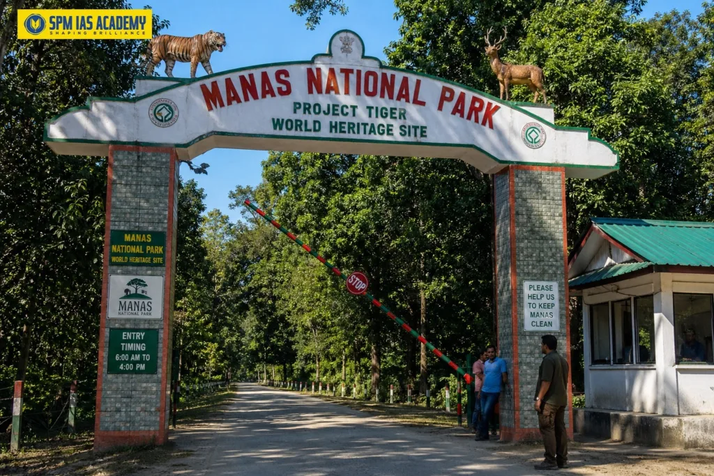
Manas National Park, Assam
Manas National Park is one of India’s most important wildlife reserves. It sits at the foothills of the Bhutan-Himalayas in Assam. The park is a UNESCO World Heritage Site, a Project Tiger Reserve, a Project Elephant Reserve, and a Biosphere Reserve. It covers an area of 950 square kilometres. The Manas River flows through the heart of the park. This river is a major tributary of the Brahmaputra. The park is home to over 20 endangered species. It is the only place in the world where pygmy hogs survive in the wild. Therefore, Manas National Park holds great importance for UPSC, APSC, and other state PCS exams.
For expert guidance, choose the best UPSC coaching center Guwahati for complete exam preparation.
Manas National Park: Quick Facts
| Feature | Details |
| Location | Chirang and Baksa Districts, Bodoland Territorial Region (BTR), Assam, India |
| Nearest City | Barpeta Road, Assam |
| Total Area | 950 sq. km (Core zone: 500 sq. km) |
| Established as Sanctuary | 1 October 1928 |
| Declared National Park | 1990 |
| UNESCO World Heritage Site | 1985 (9th Session) – Criteria vii, ix, x |
| Biosphere Reserve Declared | 1989 |
| Project Tiger Reserve | Yes |
| Project Elephant Reserve | Yes |
| Coordinates | 26°43’N 90°56’E |
| Altitude | 61 – 110 metres above mean sea level |
| International Border | Shares border with Royal Manas National Park, Bhutan |
| Main River | Manas River (tributary of Brahmaputra) |
| Annual Rainfall | Approximately 333 cm |
| Best Time to Visit | November to April |
| Nearest Airport | Guwahati (140 km) |
| Nearest Railway Station | Barpeta Road (40 km) |
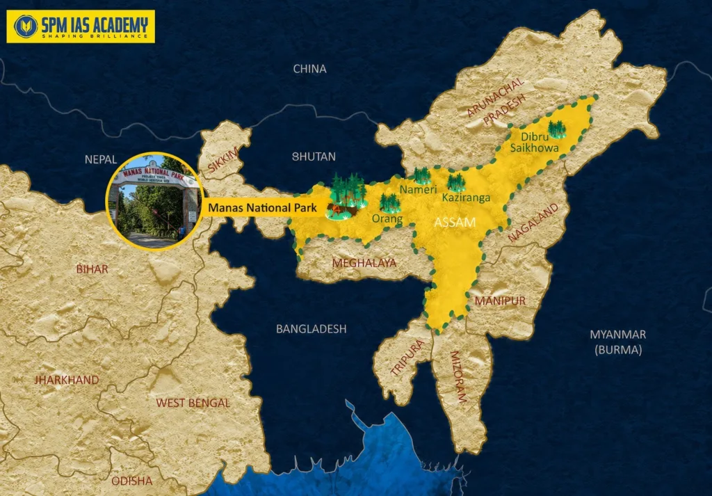
Where is Manas National Park Located?
- Manas National Park is located in the Chirang and Baksa districts of the Bodoland Territorial Region (BTR) in Assam, India.
- It lies at the foothills of the Eastern Himalayas.
- The park shares an international boundary with Bhutan. On the Bhutanese side, it connects with the Royal Manas National Park.
- This trans-boundary connection makes it ecologically very significant.
- The Manas River flows through the western part of the park. This river splits into two streams – the Bwrsi and the Bholkaduba – as it reaches the plains. Five other smaller rivers also flow through the park.
- The park sits on a wide, low-lying alluvial terrace below the outer Himalayan foothills.
Three Ranges of Manas National Park
- Western Range: Headquartered at Panbari
- Central Range: Headquartered at Bansbari, near Barpeta Road
- Eastern Range: Headquartered at Bhuiyapara, near Pathsala
Historical Background of Manas National Park
Understanding the history of Manas National Park is important for UPSC and APSC exams. The area now forming the park was once under the Kingdom of Bhutan. Britain gained control of this region after the Duar War of 1865. The area then became part of British India.
Join UPSC Online Coaching 2026 to prepare current affairs and geography topics from anywhere.
Key Historical Timeline
| Year | Event |
| Before 1865 | Area under Kingdom of Bhutan |
| 1865 | Duar War – area ceded to British India |
| 1928 (Oct 1) | Declared a Wildlife Sanctuary (391 sq. km) |
| 1985 | Declared UNESCO World Heritage Site |
| 1989 | Declared Manas Biosphere Reserve |
| 1990 | Upgraded to National Park |
| 1992 | Listed as World Heritage in Danger (due to poaching and Bodo uprising) |
| 2007 | One-horned rhinoceros re-introduced |
| 2008 (Feb 25) | Core area expanded to 500 sq. km |
| 2011 (Jun 21) | Removed from World Heritage in Danger list |
Manas National Park as a UNESCO World Heritage Site
UNESCO designated Manas National Park as a World Heritage Site in 1985. The park met three important UNESCO criteria for this recognition:
- Criterion vii: Outstanding natural beauty and aesthetic importance.
- Criterion ix: Important ongoing ecological and biological processes.
- Criterion x: Contains habitats for threatened species of exceptional universal value.
However, UNESCO placed Manas on the List of World Heritage in Danger in 1992. This happened due to heavy poaching and militant activities during the Bodo uprising. Fortunately, the park’s condition improved greatly. UNESCO removed it from the danger list on 21 June 2011. This removal recognised the strong conservation efforts made by the Indian government and local communities.
Biodiversity of Manas National Park
Manas National Park is one of the richest biodiversity hotspots in the world. The combination of Sub-Himalayan Bhabar Terai formation with riverine forests makes it exceptional. It supports a wide variety of flora and fauna.
Endangered and Endemic Wildlife
The park is home to over 20 endangered species. Several species found here are endemic to this region. These include:
- Pygmy Hog: The world’s only surviving wild population exists here.
- Golden Langur: Rare and endemic primate.
- Assam Roofed Turtle: Critically endangered freshwater turtle.
- Hispid Hare: An endangered species endemic to South Asia.
- Wild Water Buffalo: Large population found in Manas.
- Royal Bengal Tiger: Protected under Project Tiger.
- Indian One-Horned Rhinoceros: Re-introduced in 2007 after poaching wiped them out.
- Asian Elephant: Protected under Project Elephant.
- Bengal Florican: Critically endangered grassland bird.
Flora of Manas National Park
Scientists have recorded 543 plant species from the core zone. The main vegetation types are:
- Sub-Himalayan light alluvial semi-evergreen forests in the northern parts.
- East Himalayan mixed moist and dry deciduous forests.
- Low alluvial savanna woodland.
- Assam Valley semi-evergreen alluvial grasslands (covering about 50% of the park).
Geography and Climate of Manas National Park
Physical Geography:
The park lies on a wide alluvial plain below the Eastern Himalayas. The northern part has limestone and sandstone bedrock. The southern grasslands rest on deep fine alluvium deposits. The park’s altitude ranges from 61 to 110 metres above sea level.
Climate:
- Firstly, the temperature remains moderate throughout the year. The minimum temperature stays around 15°C.
- Moreover, the maximum temperature can reach about 37°C. Therefore, summers can feel quite warm.
- Additionally, the region receives heavy rainfall from May to September. This period is the monsoon season.
- Furthermore, the area gets high rainfall annually. The average rainfall is about 333 centimetres.
- Finally, the best time to visit is from November to April. During this time, the weather remains pleasant and comfortable.
Conclusion:
In conclusion, Manas National Park Assam is one of the most important wildlife reserves in India. It protects rich biodiversity, rare species, and unique ecosystems. Moreover, it is a UNESCO World Heritage Site, which shows its global importance. Furthermore, the park supports many endangered animals like the Pygmy Hog, Golden Langur, and Royal Bengal Tiger. Therefore, it plays a key role in wildlife conservation in India.
Strong UPSC Preparation in Guwahati helps aspirants master important topics like Manas National Park.
Source:
FAQ:
Manas National Park is located in Chirang and Baksa districts of Assam. Moreover, it lies in the foothills of the Eastern Himalayas near the Bhutan border.
Manas National Park is famous for its rich biodiversity and endangered species. Additionally, it is the only place where pygmy hogs survive in the wild.
Yes, Manas National Park is a UNESCO World Heritage Site. Therefore, it has global importance for conservation and natural beauty.
Manas National Park has many animals like the Royal Bengal Tiger, Golden Langur, Asian Elephant, and One-Horned Rhinoceros. Moreover, it supports over 20 endangered species.
Manas National Park covers an area of about 950 square kilometres. Moreover, the Manas River, a tributary of the Brahmaputra, flows through the park and supports its rich ecosystem.

Behind every article at SPM IAS Academy is a team of skilled content writers and subject experts committed to making preparation easier for aspirants. From answering common doubts to breaking down complex issues and current affairs, we create content that is accurate, easy to understand, and directly useful for UPSC, APSC, and other competitive exams.