
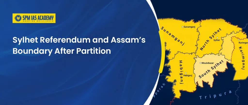
The Partition of India in 1947 changed Assam’s territory, population, and political future. To understand Assam’s Boundary After Partition, it is important to study the Sylhet Referendum. At that time, Sylhet was a Muslim-majority district of Assam. On 6 and 7 July 1947, registered voters had to decide whether Sylhet would remain with Assam in India or join East Bengal in Pakistan.
The majority voted to join East Bengal. However, the referendum alone did not determine the final international boundary. The Radcliffe Boundary Award later decided which areas would become part of Pakistan and which would remain in India. These decisions significantly shaped Assam’s southern boundary and had a lasting impact on the communities living on both sides of the border. This topic is highly relevant for aspirants preparing through Civil Services Coaching Guwahati, as it is frequently covered in UPSC and APSC examinations under Modern Indian History, Partition, and India’s political geography.
Assam Before the Partition of India
Before the Partition of 1947, Assam was much larger and different from the state we know today. It was one of the provinces under the British Raj. Historically, the province included the Brahmaputra Valley, the Surma Valley and several hill areas.
Sylhet was originally connected with Bengal. However, in 1874, the British added Sylhet to the newly formed province of Assam. However, Sylhet’s connection with Assam did not remain simple. In 1905, the British created the province of Eastern Bengal and Assam. Sylhet became part of this new province. This arrangement ended in 1912, when Assam was formed again as a separate province with Sylhet included in it.
Over time, Sylhet emerged as an important district of Assam and formed a key part of the Surma Valley. Due to its geographical proximity, it maintained close administrative, economic, and cultural links with Cachar. The region also retained strong linguistic and cultural connections with Bengal, which influenced its social and historical development. Understanding the historical significance of Sylhet is essential for APSC exam preparation, as questions related to Assam’s administrative history, the Surma Valley, and the Partition period frequently appear in APSC and UPSC examinations.
Meanwhile, the country’s political scenario was changing rapidly. During the 1940s, demand for a separate country called Pakistan became stronger. Since Sylhet had a Muslim-majority population, its future became an important issue during the Partition talks.
Finally, the British announced that the people of Sylhet would vote to decide the district’s fate. They had to choose whether Sylhet would remain in Assam and become part of India or join East Bengal in Pakistan. This decision led to the Sylhet Referendum of July 1947, which later played an important role in shaping Assam’s Boundary After Partition.
Why Sylhet Became Part of Assam?
Sylhet became part of Assam on 16 February 1874, when Assam was separated from the Bengal Presidency and became a separate Chief Commissioner’s Province. It was originally a part of the Bengal Presidency. According to the official records, Sylhet was merged with Assam for better economic and administrative efficiency. Sylhet was a large and populous district that produced surplus revenue.
Moreover, Sylhet maintained close economic ties with Assam’s expanding tea industry, supplying labour, food, and other essential goods to nearby tea-producing regions. The British administration also believed that incorporating Sylhet into Assam would improve trade, strengthen administrative efficiency, and support the economic development of the province. This historical development is important for aspirants studying at an APSC coaching centre, as it is relevant to topics on Assam’s colonial history, economic development, and administrative evolution frequently asked in APSC and UPSC examinations.
However, many people in Sylhet opposed the transfer. Most spoke Bengali or Sylheti and had strong cultural and administrative ties with Bengal. Despite their protests, Sylhet remained part of Assam from 1874 to 1947. These questions became important during the Sylhet Referendum and later influenced Assam’s Boundary After Partition.
The Political Background of the Sylhet Referendum
- Sylhet had a complex identity: Sylhet had been part of Assam since 1874. However, it continued to have close language and cultural links with Bengal. Therefore, some people saw Sylhet as part of Assam, while others felt more connected to Bengal.
- Its population made Sylhet politically important: Assam was a mainly non-Muslim province, but Sylhet was a Muslim-majority district. It also shared a boundary with Bengal. As a result, Sylhet’s future became a major political question when the Partition of India was discussed.
- The demand for Pakistan: During the 1940s, the Muslim League demanded a separate country for Muslims. The party argued that Muslim-majority Sylhet should join Muslim-majority East Bengal, which would become part of Pakistan.
- Cabinet Mission Plan Groupings: Under the Cabinet Mission Plan of 1946, Assam was placed in a group with Muslim-majority Bengal. Congress leaders in Assam opposed compulsory grouping because they feared that Assam would lose control over its own decisions. This wider debate also made Sylhet’s position more sensitive.
- The Partition of Bengal changed the situation: By 1947, British India was moving towards division. Bengal was also expected to be divided into western and eastern parts. Since Sylhet was next to the proposed eastern part of Bengal, its political future had to be settled quickly
- 3 June Plan: Finally, the British Partition Plan announced that the people of Sylhet would vote on the district’s future. This decision became an important step in the formation of Assam’s Boundary After Partition.
How the Sylhet Referendum Was Conducted in 1947
- Official announcement: Under the 3 June Partition Plan, the British government announced a referendum in Sylhet. Its outcome would play a major role in deciding Assam’s Boundary After Partition.
- Two clear choices: Voters had to choose between remaining with Assam in India and joining East Bengal, which would become part of Pakistan.
- Polling dates: The referendum was conducted over two days, on 6 and 7 July 1947. However, the authorities had very little time to complete the arrangements.
- Voting: H. C. Stork, a British civil servant, was appointed as the Referendum Commissioner. Voting took place through a secret ballot so that people could make their choice privately.
- Polling arrangements: Altogether, 239 polling centres were set up across Sylhet. The authorities appointed 478 presiding officers and 1,434 polling officers to manage the process.
- The Verdict: A majority of 239,619 votes favored joining East Bengal (Pakistan), while 184,041 votes supported remaining in Assam
Results of the Sylhet Referendum
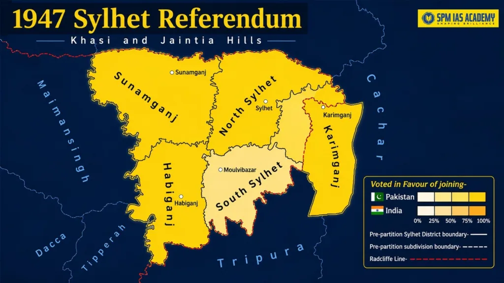
The referendum result favoured Sylhet joining East Bengal. Out of 546,815 registered voters, 423,660 cast their votes, recording a turnout of about 77.5%. Among them, 239,619 voted to join East Bengal, while 184,041 voted to remain in Assam. Thus, the proposal won by a margin of 55,578 votes.
Partition and the Transfer of Sylhet to East Pakistan
After the Sylhet Referendum, most of the district was separated from Assam and transferred to East Bengal. In 1955, East Bengal was officially renamed East Pakistan, and following the Partition of British India in August 1947, the majority of Sylhet became part of Pakistan. These developments significantly influenced Assam’s political boundaries, administrative structure, and demographic composition. This topic is particularly important for aspirants studying at an IAS coaching institute Assam, as it is frequently covered in UPSC and APSC examinations under Modern Indian History, Partition, and the historical geography of Northeast India.
However, the referendum did not settle the exact boundary. The final border was drawn under the Radcliffe Boundary Award. As a result, most of Sylhet went to Pakistan, while three-and-a-half thanas of the Karimganj subdivision remained in India. This decision divided the old Sylhet district and became a major step in forming Assam’s Boundary After Partition.
The Formation of Assam’s Boundary After Partition
The Partition of India significantly changed Assam’s southern boundary. Before 1947, the entire Sylhet district was part of Assam. However, after the referendum, most of Sylhet was transferred to East Bengal in Pakistan. This reduced Assam’s territory and created a new international border.
The referendum decided the general future of Sylhet, but it did not draw the exact border. That work was given to the Bengal Boundary Commission under Sir Cyril Radcliffe. The Commission considered the location of Muslim- and non-Muslim-majority areas, along with factors such as rivers, roads and communication links. Therefore, the final boundary did not simply follow the voting results of each subdivision.
Under the Radcliffe Award, most of Sylhet went to East Bengal. However, three-and-a-half thanas of the Karimganj subdivision remained in India. These areas were added to Assam and later formed the Karimganj district. As a result, the Barak Valley region of Assam included Cachar, Karimganj and, later, Hailakandi.
Meanwhile, the new border divided villages, markets, roads and river routes that had once been connected. Families and communities also found themselves on different sides of an international boundary. After Bangladesh became independent in 1971, this part of the former India–Pakistan border became the Assam–Bangladesh border.
However, Partition alone did not create Assam’s present-day map. Assam’s internal boundaries changed again when Nagaland became a separate state in 1963. Meghalaya became a state in 1972, while the Lushai Hills became the Union Territory of Mizoram in 1972 and a state in 1987. Therefore, Assam’s Boundary After Partition was shaped by the Sylhet Referendum, the Radcliffe Award and the later creation of new northeastern states.
Impact of Partition on Assam’s Population and Society
- Movement of people: After Partition, many Bengali Hindus left Sylhet and other parts of East Pakistan for Assam. Some Muslims also moved from India to East Pakistan. However, migration in the eastern region happened gradually and continued for several years.
- Growth of the Barak Valley population: Many displaced Sylheti families settled in Karimganj, Cachar and other parts of Assam. As a result, the population and social structure of the Barak Valley changed.
- Pressure on local resources: The arrival of displaced families increased the need for land, housing, jobs, schools and public services. Therefore, the government faced difficulties in providing proper settlement and support.
- Families and communities were divided: The new border separated relatives, villages and old social networks. People who had earlier travelled freely for work, trade or family visits now had to cross an international border.
- Language and identity became sensitive issues: Partition increased debates over Assamese and Bengali identity. At the same time, displaced Sylheti communities worked to preserve their language, customs and memories.
- Citizenship became a long-term concern: Questions about refugees, migration and legal citizenship later became important in Assam’s politics. However, not every later migration issue was caused only by the 1947 Partition.
Conclusion
The Sylhet Referendum was a turning point in the history of Assam. It removed most of Sylhet from Assam and placed it within East Bengal in Pakistan. The Radcliffe Award then decided the final border and kept part of Karimganj in India. However, these changes affected more than the map. Therefore, Assam’s Boundary After Partition cannot be understood only as a change on the map. It also explains important changes in the state’s population, identity, society and political history.
Frequently Asked Questions
The Sylhet Referendum was held on 6 and 7 July 1947 to decide whether Sylhet would remain in Assam or join East Bengal. It was organised under the British Partition Plan because Sylhet was a Muslim-majority district of Assam located next to the proposed eastern part of Bengal.
Out of 546,815 registered voters, 423,660 took part in the referendum. A total of 239,619 voted to join East Bengal, while 184,041 voted to remain in Assam. Therefore, the side supporting East Bengal won by 55,578 votes, with an overall voter turnout of about 77.5%.
After the vote, most of Sylhet was transferred to East Bengal. However, the Radcliffe Boundary Award kept three-and-a-half thanas of the Karimganj subdivision in India. These areas remained with Assam and later formed Karimganj district, helping create Assam’s new southern international boundary with East Pakistan in 1947.

Behind every article at SPM IAS Academy is a team of skilled content writers and subject experts committed to making preparation easier for aspirants. From answering common doubts to breaking down complex issues and current affairs, we create content that is accurate, easy to understand, and directly useful for UPSC, APSC, and other competitive exams.