
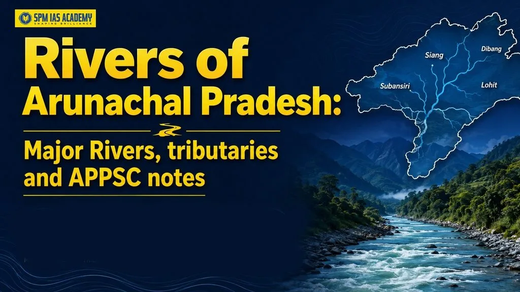
The rivers of Arunachal Pradesh form an extensive drainage network across the Eastern Himalayas. Most of these rivers flow through steep mountain valleys and deep gorges before entering the plains of Assam. They are an important part of the Brahmaputra river system and play a major role in supporting the state’s biodiversity, agriculture, settlements, fisheries, and hydroelectric-power potential. For aspirants preparing for competitive examinations, understanding these rivers is important for topics related to geography, environment, natural resources, and the physical features of Northeast India. Students can also benefit from structured guidance through the best APSC online coaching in Assam while preparing these regional geography topics.
Features of the Rivers in Arunachal Pradesh
- Himalayan terrain: Most rivers flow through the steep slopes, narrow valleys and deep gorges of the Eastern Himalayas. As a result, they generally have strong currents and high erosion capacity.
- Perennial nature: Major rivers such as the Siang, Subansiri, Kameng, Dibang and Lohit flow throughout the year. However, their water levels rise considerably during the monsoon.
- Perennial nature: Major rivers such as the Siang, Subansiri, Kameng, Dibang and Lohit flow throughout the year. However, their water levels rise considerably during the monsoon.
- Brahmaputra connection: Most rivers of Arunachal Pradesh belong to the Brahmaputra river system. The Siang forms its principal channel, while the Dibang and Lohit join it before the combined river flows into Assam. Similarly, rivers such as the Subansiri and Kameng later meet the Brahmaputra as major tributaries.
- Regional importance: Besides shaping the state’s landscape, these rivers support biodiversity, agriculture, fisheries, local livelihoods and hydropower generation. Thus, they hold geographical, economic and environmental importance for Arunachal Pradesh.
List of Major Rivers of Arunachal Pradesh
The rivers of Arunachal Pradesh mainly belong to the Brahmaputra drainage system and form an important network across the state’s mountainous terrain. The Siang is a principal river, while the Dibang and Lohit join it before the combined flow enters the plains of Assam. The Subansiri and Kameng also form major tributaries of the Brahmaputra farther downstream. In the eastern and southeastern parts of Arunachal Pradesh, rivers such as the Noa-Dihing and Tirap drain the region. Understanding this river network is important for studying the geography and drainage system of Northeast India, making it a useful topic for students attending APSC online classes.
Siang River
- Origin and different names: The Siang originates in Tibet, where it is known as the Yarlung Tsangpo. It enters Arunachal Pradesh near Gelling in Upper Siang district. Farther downstream, it is also referred to as the Dihang.
- Course through Arunachal Pradesh: After entering India, the river flows through Upper Siang, Siang and East Siang districts. Along its course, it passes through steep gorges, forested valleys and settlements such as Yingkiong and Pasighat.
- Important tributaries: The Siyom, Yamne and Simang are among the important rivers that feed the Siang. In addition, several smaller mountain streams contribute to its discharge
- Connection with the Brahmaputra: Near the Assam plains, the Siang joins the Dibang and Lohit. Thereafter, the combined river flows through Assam as the Brahmaputra.
- Economic and cultural importance: The river supports agriculture, fishing, local livelihoods, and adventure tourism. Moreover, it holds deep cultural importance for communities living in the Siang Valley.
- APPSC fact: Remember the name sequence—Yarlung Tsangpo in Tibet, Siang or Dihang in Arunachal Pradesh and Brahmaputra in Assam.
Subansiri River
- Origin: The Subansiri originates in the Tibetan Himalayan region. It then enters India through the mountainous northern part of Arunachal Pradesh.
- Course through the state: The river flows mainly through the Upper Subansiri region. Its extensive basin also drains parts of Kamle, Lower Subansiri and adjoining areas.
- Important tributaries: The Subansiri river system receives water from rivers such as the Kamla, Kurung, Kumey, Sigin and several smaller streams. The Panyor and Dikrong also drain the wider Subansiri–Brahmaputra region.
- River joined: After leaving the hills of Arunachal Pradesh, the Subansiri enters Assam and joins the Brahmaputra.
- APPSC Fact: The Subansiri River is one of the most important north-bank tributaries of the Brahmaputra. It originates in the Tibetan Himalayas and flows through Arunachal Pradesh before entering Assam and joining the Brahmaputra. The river is significant from both geographical and economic perspectives, particularly because of its hydropower potential and role in the regional drainage system. Aspirants preparing through IAS coaching in Guwahati should understand the Subansiri’s origin, course, tributary system, and importance for Northeast India’s geography.
Kameng River
- Origin: The Kameng rises in the high Himalayan region near the India–Tibet border. Snowmelt, mountain springs and rainfall feed the river and its headstreams.
- Course through Arunachal Pradesh: The wider Kameng river system drains parts of Tawang, West Kameng and East Kameng. Subsequently, the river flows through the foothills near Bhalukpong before entering Assam.
- Important tributaries: The Bichom, Tenga and Dirang Chu are important tributaries of the Kameng system. Several streams draining the Tawang and West Kameng highlands also contribute to the wider basin.
- Different name in Assam: After entering Assam, the Kameng is commonly known as the Jia Bharali
- Regional importance: The river supports forests, wildlife habitats, agriculture and river-based tourism. Furthermore, parts of the Kameng basin are suitable for rafting and hydroelectric power development
- APPSC fact: Kameng in Arunachal Pradesh is known as Jia Bharali in Assam.
Dibang River
- Origin: The Dibang River system originates in the high mountains of Dibang Valley. It develops from several headstreams, of which the Dri and Mathun are especially important.
- Course through the state: The Dibang River flows through the Dibang Valley and Lower Dibang Valley districts of Arunachal Pradesh. As it moves towards the foothills, the valley gradually becomes wider, and the river develops multiple channels across the landscape. This course reflects the influence of the region’s mountainous terrain and changing river morphology. Understanding the Dibang’s course is useful for aspirants studying the physical geography and drainage system of Northeast India through online coaching in Assam.
- Important tributaries: The Dri, Mathun, Emra and Ithun are important components of the Dibang drainage system. Numerous smaller streams from the Mishmi Hills also feed the river.
- River joined: After entering the plains, the Dibang joins the Siang–Lohit river system. Together, these rivers contribute to the main Brahmaputra channel.
- Ecological importance: The Dibang basin contains dense forests, wetlands, and diverse wildlife habitats. Therefore, it is environmentally significant as well as important for local communities.
- APPSC fact: The Dibang is one of the three major eastern rivers—Siang, Dibang and Lohit—associated with the formation of the Brahmaputra in the Assam plains.
Lohit River
- Origin: The Lohit originates in eastern Tibet and enters India through the mountainous eastern part of Arunachal Pradesh.
- Course through Arunachal Pradesh: It flows through the deeply dissected terrain of Anjaw and Lohit before reaching the lower areas towards Namsai and the Assam plains.
- Important tributaries: The Tidding, Dalai, Tellu and Kamlang are among the important rivers and streams associated with the Lohit system. Moreover, many smaller mountain streams increase its discharge during the monsoon.
- River joined: The Lohit joins the Dibang and Siang system near the Assam plains. Consequently, it becomes an important contributor to the Brahmaputra.
- Cultural importance: Parshuram Kund, an important Hindu pilgrimage site, is located on the Lohit. Thousands of pilgrims visit the site, especially during Makar Sankranti
- APPSC fact: The Lohit is important for both physical geography and culture because it is a major Brahmaputra tributary and is associated with Parshuram Kund.
Noa-Dihing River
- Origin: The Noa-Dihing originates in the Patkai–Namdapha hill region of eastern Arunachal Pradesh. Heavy rainfall and numerous forest streams feed the river.
- Course through the state: It flows through parts of Changlang and Namsai. Its course passes through a densely forested region with high ecological diversity.
- Important tributaries: The Namdapha, Dapha and other smaller streams of the Patkai region contribute to the Noa-Dihing drainage system.
- Rivers Joined: After flowing towards the plains, the Noa-Dihing becomes connected with the Lohit river system.
- Ecological importance: The river and its tributaries drain parts of the Namdapha landscape, one of the most biodiverse regions of Arunachal Pradesh. Thus, they support rich forests and aquatic habitats.
- Local importance: The river provides water for settlements, agriculture and fishing. However, heavy monsoon rainfall can cause erosion and changes in its channels.
- APPSC fact: Associate the Noa-Dihing with Changlang, Namsai and the Namdapha landscape.
Tirap River
- Origin: The Tirap rises in the Patkai hill region near Laju–Wakka in southeastern Arunachal Pradesh.
- Course through Arunachal Pradesh: It drains parts of Tirap district and then flows towards the Changlang region and the Assam plains.
- Sources of water: Unlike the heavily snow-fed Himalayan rivers, the Tirap depends greatly on monsoon rainfall, mountain springs and local hill streams. Therefore, its discharge rises considerably during the rainy season.
- Important tributaries: Numerous smaller streams from the Patkai Hills feed the river. The wider southeastern drainage region also contains rivers such as the Namchik, Namphuk, Namsang and Namphai.
- River joined: The Tirap eventually becomes part of the Burhi-Dihing drainage system, which later joins the Brahmaputra.
- Regional importance: The river supports agriculture, forest ecosystems and settlements in southeastern Arunachal Pradesh. Moreover, it forms an important part of the drainage network of the Patkai region.
- APPSC fact: The Tirap belongs to the southeastern drainage system and should not be grouped with the Siang–Dibang–Lohit confluence.
Quick APPSC Revision
| Question | Answer |
| Principal river of Arunachal Pradesh | Siang |
| Siang in Tibet | Yarlung Tsangpo |
| Kameng in Assam | Jia Bharali |
| River associated with Parshuram Kund | Lohit |
| River associated with Namdapha | Noa-Dihing |
| Important headstreams of the Dibang | Dri and Mathun |
| Major north-bank tributaries | Subansiri and Kameng |
| Southeastern river system | Tirap |
| Rivers contributing to the main Brahmaputra channel near the Assam plains | Siang, Dibang and Lohit |
Rivers of Arunachal Pradesh from East to West
Knowing the east-to-west order of the major rivers is useful for APPSC and other competitive examinations. The five major rivers can be arranged as follows:
East-to-West Sequence
Lohit → Dibang → Siang → Subansiri → Kameng
| Order | River | Simple fact |
| 1 | Lohit | It flows through eastern Arunachal Pradesh and is linked with Parshuram Kund. |
| 2 | Dibang | It flows through Dibang Valley and later meets the Siang–Lohit river system. |
| 3 | Siang | It flows through central Arunachal Pradesh and forms the main channel of the Brahmaputra. |
| 4 | Subansiri | It flows west of the Siang and later joins the Brahmaputra in Assam. |
| 5 | Kameng | It flows through western Arunachal Pradesh and is called Jia Bharali in Assam. |
Economic Importance of Rivers of Arunachal Pradesh
Rivers such as the Siang, Subansiri, Kameng, Dibang, Lohit and Noa-Dihing play an important role in Arunachal Pradesh’s economy. They support electricity generation, agriculture, fisheries, tourism and the daily needs of local communities.
Hydroelectric-power potential
- Firstly, Arunachal Pradesh has steep mountain slopes, deep valleys and fast-flowing perennial rivers. These physical conditions make the state highly suitable for generating hydroelectricity.
- Moreover, a Central Electricity Authority study estimated the state’s probable installed hydroelectric capacity at around 60,000 MW, the highest among Indian states.
- For example, hydroelectric projects have been planned or developed in the Subansiri, Siang, Dibang, Kameng and Ranganadi river basins.
- Furthermore, hydropower can supply electricity to villages, support industries and generate revenue for the state through the sale of surplus power.
- However, large dams must be planned carefully because they may affect forests, wildlife, river ecosystems and the settlements and livelihoods of local communities.
Agriculture and Irrigation
- Secondly, rivers, streams and springs supply water to agricultural fields, especially in valleys and relatively level areas.
- For instance, the Apatani people of Ziro Valley use a traditional system of channels to divert stream water into terraced paddy fields.
- Additionally, this system supports the cultivation of rice and the rearing of fish in the same field. Thus, water is used efficiently for both agriculture and fisheries.
- Moreover, rivers deposit sand, silt, and other sediments in valleys and low-lying areas. These deposits can improve soil fertility.
- However, the steep terrain limits the construction of large irrigation networks. Therefore, small channels, bamboo pipes, gravity-based irrigation and community-managed systems are more suitable in many areas.
Fisheries
- Thirdly, rivers provide fish for food, local markets and household income.
- In particular, the cold and oxygen-rich rivers of the state support species such as mahseer, snow trout and other indigenous fish.
- Furthermore, Arunachal Pradesh has around 2,000 kilometres of rivers and canals that form part of its inland fishery resources.
- Besides this, fish farming in ponds, paddy fields and suitable cold-water areas creates employment and improves food security.
- Similarly, recreational fishing or angling attracts visitors and generates income for local guides, homestays and tourism operators.
- Nevertheless, overfishing, destructive fishing practices, pollution and changes in river flow can reduce fish populations. Therefore, sustainable fishing and habitat protection are necessary.
Drinking-water supply
- Fourthly, rivers, small streams, springs and rivulets are important sources of drinking water in both rural and urban areas.
- Moreover, surface water is collected and supplied to households through gravity-based pipelines, storage tanks and village water-supply systems.
- A Jal Jeevan Mission assessment found that 64% of the surveyed village water schemes in Arunachal Pradesh were based on surface-water sources.
- As a result, rivers and their smaller tributaries reduce the dependence of remote settlements on deep groundwater extraction.
- However, water taken directly from a river or stream may contain sediments and harmful microorganisms. Therefore, filtration, treatment and regular water-quality testing are essential.
- At the same time, the drying of springs and small rivulets is becoming a concern. Hence, protecting forests, catchment areas and springsheds is necessary for long-term water security.
Transport: limitations and opportunities
Limitations
- Finally, rivers have only a limited role in regular inland transport within Arunachal Pradesh.
- This is mainly because most rivers flow rapidly through steep slopes, rocky channels, narrow gorges and waterfalls.
- Moreover, river depth and flow change considerably between the monsoon and dry seasons.
- As a result, large-scale and year-round movement of cargo or passengers is difficult in most upstream areas.
- In addition, floods, landslides, rapids and shifting river channels create safety risks.
Opportunities
- Nevertheless, boats and local ferries can be used for short-distance travel and river crossings in suitable lower and calmer stretches.
- Similarly, rafting boats may help tourists reach remote areas that are difficult to access by road.
- In the future, carefully selected river stretches may support small-scale passenger movement, tourism and the transportation of light goods.
- However, any transport project must be based on proper studies of river depth, seasonal flow, safety and environmental impact.
Major Hydroelectric Projects in Arunachal Pradesh
The fast-flowing rivers and steep Himalayan terrain give Arunachal Pradesh significant hydropower potential. The following project status is based on official information available as of August 2026.
| Project | River and district | Status and capacity |
| Panyor Lower HEP—formerly Ranganadi HEP | Panyor River, Keyi Panyor region | Operational – 405 MW |
| Pare HEP | Pare River, Papum Pare | Operational – 110 MW |
| Kameng HEP | Kameng basin, West Kameng | Operational – 600 MW |
| Subansiri Lower HEP | Subansiri River, Kamle–Assam border | Partly operational – 1,000 MW commissioned out of 2,000 MW |
| Dibang Multipurpose Project | Dibang River, Lower Dibang Valley | Under construction – 2,880 MW |
| Etalin HEP | Dibang basin, Dibang Valley | Pre-construction stage – 3,097 MW proposed |
| Heo HEP | Siyom sub-basin, Shi Yomi | Under construction – 240 MW |
| Tato-I HEP | Siyom river system, Shi Yomi | Under construction – 186 MW |
Conclusion
The rivers of Arunachal Pradesh shape the state’s geography, ecology and economy. From the Siang and Subansiri to the Dibang and Lohit, these rivers support agriculture, fisheries, hydropower and local livelihoods. However, their sustainable use requires careful planning. Therefore, APPSC aspirants should understand their origins, tributaries, courses, economic importance and environmental challenges.
Frequently Asked Questions
Q1. Which are the major rivers of Arunachal Pradesh?
The major rivers of Arunachal Pradesh include the Siang, Subansiri, Kameng, Dibang, Lohit, Noa-Dihing and Tirap. Most belong to the Brahmaputra drainage system. Moreover, numerous tributaries and mountain streams feed these rivers, creating an extensive drainage network across the state’s Himalayan terrain and valleys.
Q2. How does the Siang River become the Brahmaputra?
The Yarlung Tsangpo enters Arunachal Pradesh near Gelling and becomes known as the Siang. It then flows through Upper Siang, Siang, and East Siang districts. Subsequently, the Siang meets the Dibang and Lohit near the Assam plains, after which the combined river flows as the Brahmaputra.

Behind every article at SPM IAS Academy is a team of skilled content writers and subject experts committed to making preparation easier for aspirants. From answering common doubts to breaking down complex issues and current affairs, we create content that is accurate, easy to understand, and directly useful for UPSC, APSC, and other competitive exams.